Chasing Epic Vistas Riding The Grand Canyon And Beyond
Discovering remote routes following the rhythm of the Colorado River.

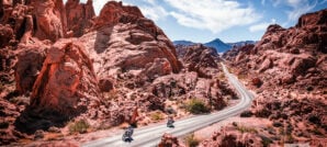
The American Southwest never ceases to amaze. Unique history, rare wildlife, and breathtaking landscapes are collected here in such a way as to make this corner of the globe look like it was designed after a postcard rack. Our rough plan for this ride was to do some camping along the Colorado River in the Grand Canyon and Glen Canyon. From the 30,000-foot perspective, a plan like this can quickly become pretty overwhelming.
Setting out to explore the Colorado River, or even just the Grand Canyon, is a huge task when you consider the sheer magnitude of these places. It’s the 5th longest river in the U.S., covering 1,450 miles, flowing through eleven national parks and monuments, seven states, and two nations. At 260,000 square miles, the Colorado River Basin accounts for around eight percent of the continental United States’ land mass.
The Grand Canyon is no less colossal. Spanning 277 miles long, with an average depth of a full mile and distance rim to rim averaging about 10 miles, it’s often considered to be the largest canyon in the world by volume.
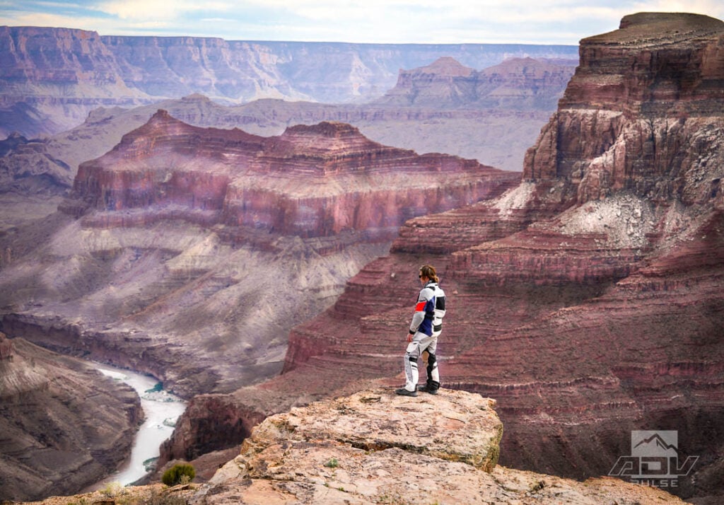
With an overwhelming amount of options to explore, sometimes distilling travel plans down to their most basic elements makes things that much easier. The elements we were looking for on this trip were simply finding the best cliff-top campsites, with views of the Colorado River along the Grand Canyon and further north into Glen Canyon. Having previously written a similar story exploring the Grand Canyon’s North Rim, for this trip we opted for the South Rim.
Most people associate the South Rim with the massive crowds around Grand Canyon Village and packed tour buses traveling along Desert View drive, but we’d be steering clear of all that. For those who know where to look, there are several hidden gems along the South Rim, offering equally impressive views, without the tourist chaos and congestion, and that’s exactly where we were heading.
Into The Darkness
It seems this land holds such greatness that it has a sense of humor about itself — like it has no need to show itself off. Within minutes of starting our route from Williams, Arizona, our first pause would be in a pitch-black location where you couldn’t even see your hand in front of your face, much less any sort of landscape.

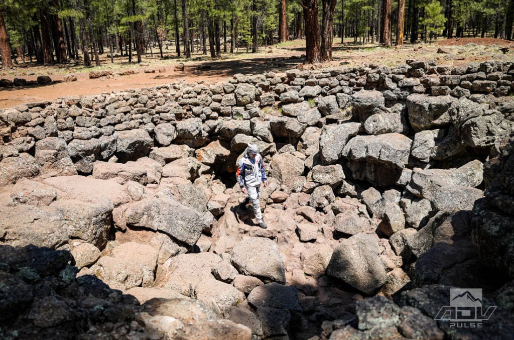
Due north from Bellmont, smooth and fast forest roads lead away from the pavement of Route 40 to the Lava River Cave. First discovered in 1915, this underground natural wonder is over three-quarters of a mile long, and its internal dimensions range from crawlspaces to sections so enormous they resemble a 700,000 year-old abandoned subway tunnel.

I was running a full hydration pack inside my Leatt ADV 7.5 MultiTour jacket, which made the crawlspaces a bit tight, but I was thankful to have the water with me for what was a longer underground hike than anticipated. Having all the layers, armor, and ADV boots was a mixed blessing. Exceptionally rough terrain in spots make hiking heavy gear much more difficult than it would have been in lightweight hiking attire, but we did have the advantage of reducing the chances of twisting an ankle or similar mishap. Always look on the bright side, even in a pitch-black cave.
Having only glanced briefly at the various signs leading to the cave entrance, details about where we were headed weren’t fully absorbed until after we’d entered. One of those details was thinking there was an exit at the opposite end.

After hiking underground for over three-quarters of a mile, the often expansive tunnel very quickly pinches down to a crawl space perhaps suited for a small child to continue on exploring, but no one much larger than that. We later saw that one of the signs outside labels this portion the “Ending Point,” so it’s fairly safe to say there’s not much to see beyond that spot.

For those not wanting to commit to the full hike, the first half of the cave arguably contains the most diverse and dramatic features, including interesting ice formations at the beginning, the highest ceiling of the cave, and a split where you can opt to choose between left or right tunnels. The halfway point is easily recognizable by a sharp left turn with a very low ceiling.


Through The Forest
Back above ground, with the Himalayan 450 I’d be riding for this trip fully loaded up for a few days of camping, the bike felt very much at home in the Kaibab National Forest of northern Arizona. Some moderately technical sections of rocky and rutted roads must be navigated to get around this part of the state. Numerous extinct volcanoes of varying sizes tower above the trails here, which are part of the San Francisco Volcanic Field. Towards the east, this volcanic area also contains the highest point in Arizona, Humphreys Peak, at 12,633 feet.

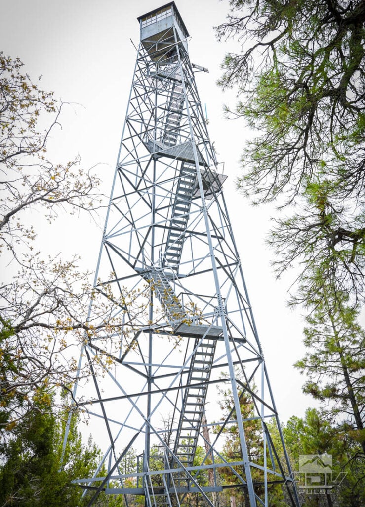
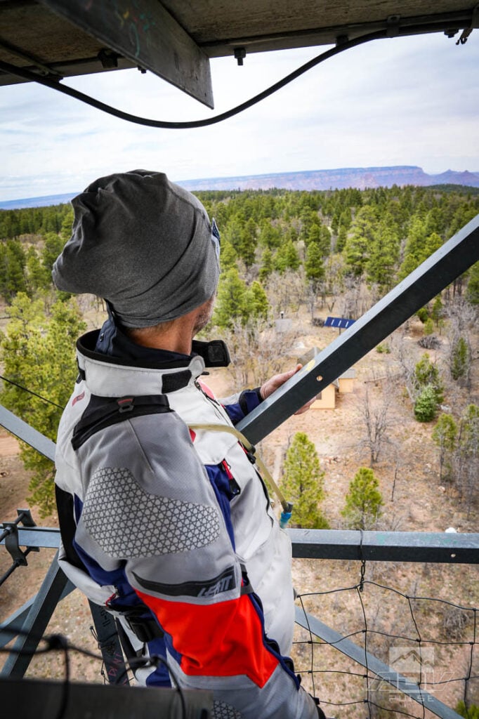
Riding in the most rocky and technical portions of the route, it’s humbling to see the ease with which small herds of wild horses dart around through the rocks and trees. Swapping out the street-biased stock tires on the Himalayan for a set of Dunlop’s Trailmax Raids with knobby tread was definitely a change that made this and a few other sections of the trail that much easier and more enjoyable. For the most part, however, the riding is fast and easy going. This allows more time for detours and additional sightseeing, and the Grandview Lookout Tower is worth a visit.


Constructed in 1936, this 80-foot tower provides (grand) views of both the Grand Canyon, and the Grandview Trailhead of the Coconino Rim Trail. The Coconino Rim Trail is a portion of the 800-mile non-motorized Arizona trail, which stretches the entire length of the state from Mexico to Utah. Those willing to climb the eerily flexible steel structure can take in the landscapes along this portion of the trail adjacent to the Grand Canyon. But, pay heed to the signs warning visitors to avoid climbing the tower in high winds or stormy conditions. Weather can change quickly here and lightning strikes are a very real danger.

Entering Navajo Nation
Dense forests give way to open desert landscapes as you approach the Navajo Nation from the south. Hopping on highway 89 to make some time northward towards Cameron and fuel, the Himalayan 450 proved to be a much better mile-eater than expected. Having spent extensive time on the original Himalayan, I was mentally geared up for a highway experience on this trip roughly the level provided by a 1987 KLR650. To my surprise, 80mph cruising speeds were easily accomplished with minimal handlebar or peg vibration. Perhaps even more surprising, after reaching Cameron and filling up, the bike was averaging 72 mpg over mixed terrain.

Having already purchased the $15 per day permits required to enter the Nation ahead of time, we were able to pull off Highway 89, directly into more fast and flowy dirt roads. Where the trees of the Kaibab National Forest gave way to open desert landscapes, the open desert landscapes would soon give way to one of the most impressive vistas anywhere on earth.

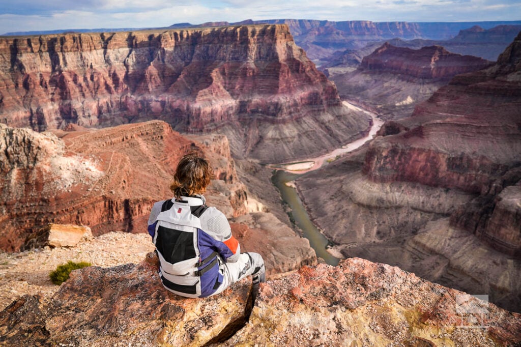
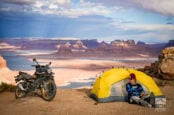
Even with a capable adventure bike, Confluence Point Overlook is roughly an hour from the nearest paved road by motorcycle. While it’s also roughly an hour from the nearest anything, somehow this area has decent LTE cellphone reception. At 6,000 feet in elevation, this remote point is where the Little Colorado River flows in from the southeast to meet the Colorado River 3,200 feet below on its journey towards the Sea of Cortez. Looking across the canyon, and 2,500 feet higher, trees lining North Rim can be seen.

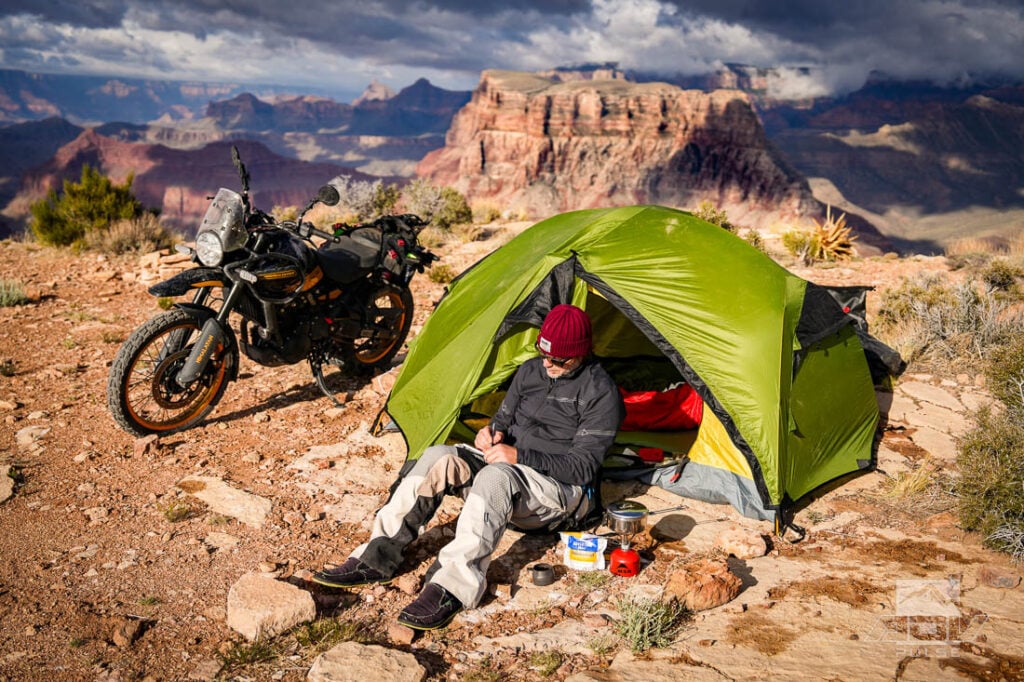
In contrast, there are no trees on the South Rim to obscure views of the staggering geology of this massive rift in the earth. Be aware, the views here are as spectacular as the wind can be. A dead-calm afternoon can change to tent-murdering gale force winds after the sun sets and the canyon starts doing unique things with temperature change and air pressure differences.

No campfires are permitted in the Navajo Nation, but temps were mild at night in late May. As the strong winds began to whip through camp, I placed several large rocks in my tent and set up my stove just inside the vestibule. After heating up dinner under a thick carpet of stars, I decided to remove the tent’s rain fly before going to sleep.
The plan worked by reducing the amount of fabric acting like a torn sail, and I slept pretty well through the maelstrom… until the first drops fell. An unforecasted lightning storm brought a brief gasp of rain sometime in the midnight hours. Fortunately, it was so brief that even the screen enclosure of the tent kept everything dry, and I took the opportunity to throw on the rain fly before returning to sleep.

Waking to an actual rainstorm just before dawn created a mix of joy and trepidation. A bit of rain could mean amazing traction and zero dust for the day. Too much rain could result in an hours-long slog through the mud just to get back on trail. According to Navajo mythology, Coyote holds powers over rain. While we didn’t see any Coyotes on the trail, perhaps this mythical troublemaker was in a good mood, as the rain subsided just in time for us to grab a quick breakfast, some coffee and hit the trail in dust-free conditions.
Pausing to look around while repairing a front flat tire on the Himalayan underscored how vast and empty this desert is. During two days of riding on the reservation land, we never saw another person.

It also served as a reminder that Royal Enfield includes a fairly decent under-seat toolkit with this bike, although missing the hex key required for the front wheel. Regardless of which bike you’re riding, securing the necessary tools prior to departing for a trip like this is always a prerequisite.
Ride To The Bottom

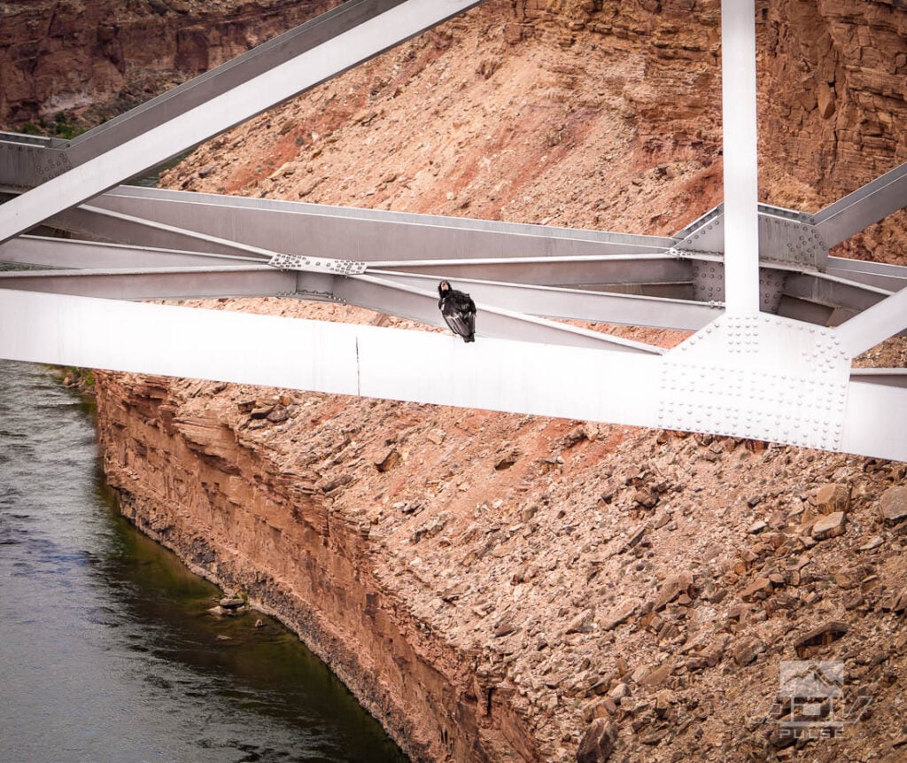
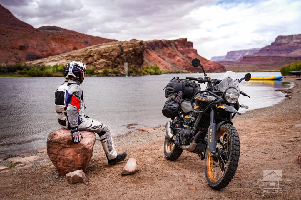
Our journey north eventually brought us to what is considered the beginning of the Grand Canyon — Lee’s Ferry. For over 50 years, from 1872 to 1928, it was the only means of crossing the Colorado River in this part of the U.S.. On January 12, 1929, a Flagstaff newspaper referred to the opening of the Navajo Bridge as “the biggest news in southwest history.” This claim is justified when you consider that this bridge soaring 467 feet above the water below was the only means of crossing the Colorado River for over 600 miles.

As vehicle size and weight grew over the following decades, a replacement for the Navajo Bridge was needed. On October 14, 1994 ironworkers installed the 16-inch diameter steel pin connecting the two halves of the new, wider Navajo Bridge. A testament to the engineers of the original bridge, the new Navajo bridge was constructed in almost the same manner, reflecting the original type, scale, proportion, and materials of the original bridge from 67 years earlier.

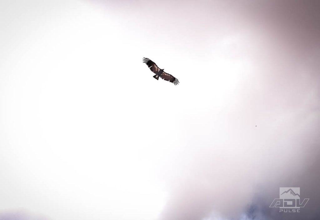
Jumping from the bridges is not permitted, however traffic is not exclusively reserved to the road surface. Parking the bikes and walking across the old bridge, which is now reserved exclusively for pedestrian traffic, two majestic Condors could be seen soaring through the canyon and landing on the support structure of the newer bridge for all to see.

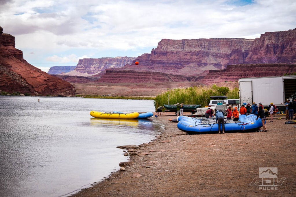
Six miles upstream from these parallel bridges, the Lee’s Ferry site is still bustling with activity. Featuring a couple large parking areas at water’s edge for sightseers, hikers, birders, anglers, and history buffs, this location also serves as a starting point for adventurous rafters looking to navigate the Colorado River. Looking downstream at the growing canyon walls, a group of rafters were preparing for 16 days of paddling from here all the way to Diamond Creek, 225 river miles away. This massive canyon doesn’t stop where the rafters would, however, as the end of the canyon is still a full 50 miles beyond Diamond Creek.

Riding Through A Moonscape
Temperatures drop significantly riding along Highway 89 over Antelope Pass on the way northward to Lake Powell. Fortunately, this is where I discovered the vents on the Leatt MultiTour jacket and pants are relatively easy to close while riding. Page is the last major city before reaching Lake Powell. Created by the Glen Canyon Dam, and up to 186 miles long at its maximum, this massive lake harnesses up to 27,000,000 acre-feet of Colorado River water, providing water storage for Colorado, Utah, Wyoming, and New Mexico.

At full pool, Lake Powell is around 254 square miles, and its shoreline can reach a staggering 1,960 miles in length. For reference, that’s enough area to put one-quarter of Rhode Island’s land mass underwater. Given there is virtually no infrastructure or pavement surrounding the lake, adventure travelers can find what seems like endless terrain to explore.
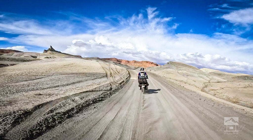
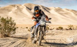
Riding through Moonscape-like smooth hills created by a vast inland sea that existed here millions of years ago, groomed dirt roads follow a wide perimeter above the northwestern shores of Lake Powell. A small wooden sign marks the sharp turn where a 2-track splits off from the main road and begins a five-mile ride out to Alstrom Point. Possibly one of the most fun five miles of the trip, this 2-track is made up of banked and predictable corners with just enough sand thrown in to make things interesting. The Dunlop Trailmax Raid tires had already proven themselves in rocks and loose gravel conditions over the past couple days, and here they hooked up just as well in the sand along this fast stretch.
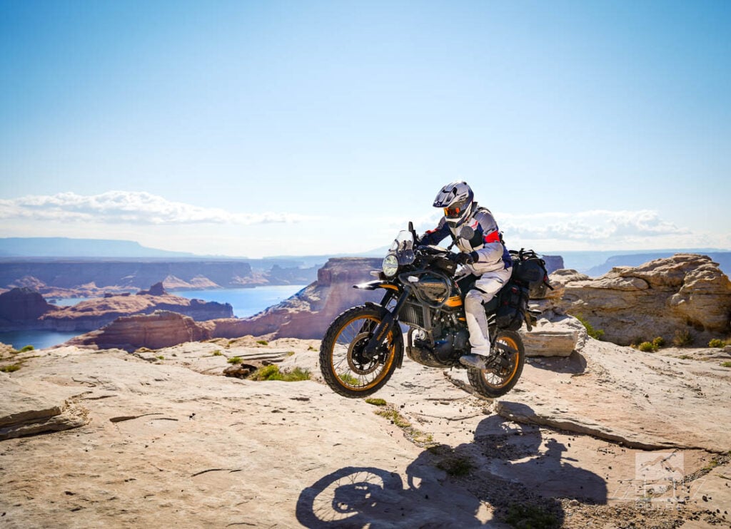
The last mile or so of this out-and-back road gets even more interesting, as the track all but disappears over rocky fields. Small cairns here and there mark the path for 4×4 overlanders. On a capable motorcycle, veering off the path here has its own rewards. Fun and moderately challenging obstacles make for a great playground, even with a fully-loaded adventure bike.

To that end, if there was any doubt that Royal Enfield’s new Himalayan should be taken seriously as an adventure bike, this trip erased it for me. Having spent extensive time on the original Himalayan, the new 450 feels like a uniquely understated machine. Freeway speeds are no problem, although it might struggle a bit on uphills or headwinds with a full load of luggage aboard.
The engine isn’t super snappy, but has great torque and what seems like a heavy flywheel, meaning very little clutch work is required, even in technical riding. Spooning on the Dunlop Trailmax Raids made things all that much better by providing high amounts of grip in the tricky sections. Additional confidence riding in the remote areas we traveled came with the excellent fuel economy and range the bike achieved with its 4.5-gallon fuel tank.
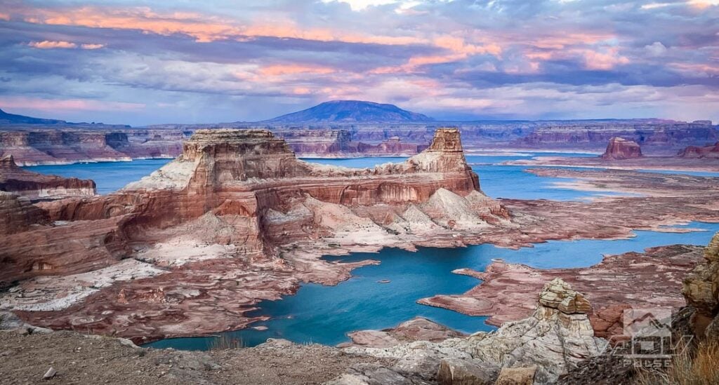
Towering Red Rock Rising From The Sea
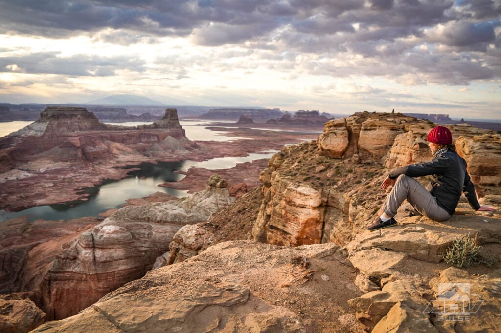
As fun as it was playing around on the bike in these trails, it’s difficult to top the sight of Alstrom Point. Panoramic views that look like painted backgrounds from a movie set are found in every direction. We set up camp in an environment that looked like something Arthur C. Clarke might have dreamed up for one of his novels we haven’t yet discovered. Vividly multicolored barren mountains imported from a Martian scene rise up out of a Tahitian-blue sea. At first glance it looks like someone had tripped and bumped the saturation setting for Southern Utah to maximum.
There are no trees for miles around, however there are numerous self-styled unimproved campsites all over this remote point. By foraging a few of these vacant spots, you can usually find scraps of unused firewood discarded by 4×4 travelers. Or, in our case, a tree trunk left unburnt in a pile of rocks — perfect for making a bed of coals to cook a steak dinner that evening.
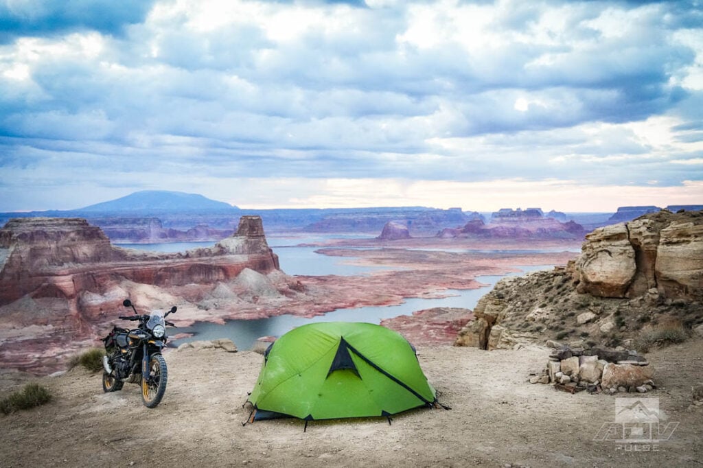


In stark contrast to the previous night, Lake Powell featured calm conditions and ideal temperatures. As the wood was reduced to coals I positioned a couple rocks and the small grill I’d been toting to get some dinner ready in the waning sunset light. Marinated carne asada we had picked up in Page was perfectly tenderized after bouncing around in a saddlebag for the past 40 or 50 miles. Difficult to decide which is better — cliffside grilling under the stars or opening your tent in the morning to views you still can’t believe you saw just the previous afternoon.

Heading Back In Time
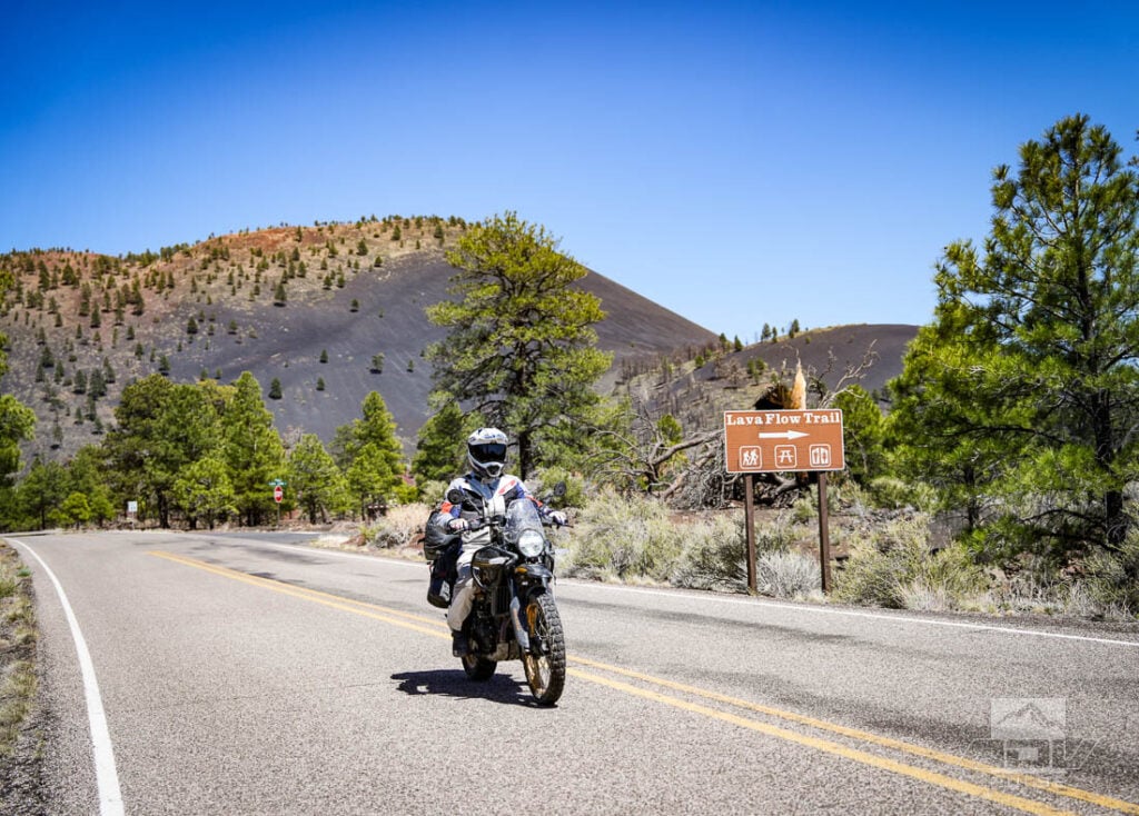
Sticking primarily to asphalt on our return journey, both natural and artificial history can be found just off Highway 89 a short distance from Flagstaff. A $20/motorcycle entrance fee gets you into the Sunset Crater National Monument. Only about 1,000 years old, Sunset Crater is the youngest volcano in Arizona. Following the loop road from Sunset Crater brings you through ruins from some of the original inhabitants of this part of Arizona.
Before the loop road detour to Sunset Crater reconnects with Highway 89 to the south, it passes by several sites, including the Wukoki Pueblo. Remnants of this impressive eight room structure have withstood the tests of time since the Ancestral Puebloan peoples who built it abandoned the area sometime between the early 1100s to mid 1200s AD. Although no one lives here today, the Hopi believe spiritual guardians remain to the present day.


While we rode a wide variety of terrain and saw a lot of amazing and diverse sites in our few days following a portion of the Colorado River, we barely scratched the surface of what this colossal river offers to adventure travelers. It’s yet another place which serves as a reminder of how much can be discovered aboard an adventure bike in just a few days. Arguably, no other mode of travel exists that could provide so much exploration, in such a condensed amount of time. Leave only tire tracks, take only photos… even if some of those photos might be so visually stunning they appear fake to anyone who wasn’t there with you.
Maps and GPS Tracks

Want to do this ride? A large interactive map and downloadable GPX Tracks are available free.* Note: Zip downloads don’t work with the Facebook app. Download using a regular browser such as Chrome, Safari etc.
* Terms of Use: Should you decide to explore a route that is published on ADV Pulse, you assume the risk of any resulting injury, loss or damage suffered as a result. The route descriptions, maps and GPS tracks provided are simply a planning resource to be used as a point of inspiration in conjunction with your own due diligence. It is your responsibility to evaluate the route accuracy as well as the current condition of trails and roads, your vehicle readiness, personal fitness and local weather when independently determining whether to use or adapt any of the information provided here.
Photos by Rob Dabney and Jon Beck
Author: Jon Beck
Jon Beck is fulfilling a dream of never figuring out what to be when he grows up. Racing mountain bikes, competitive surfing, and touring as a musician are somehow part of what led Jon to travel through over 40 countries so far as an adventure motorcycle photographer, journalist, and guide. From precision riding for cameras in Hollywood, to refilling a fountain pen for travel stories, Jon brings a rare blend of experience to the table. While he seems happiest when lost in a desert someplace, deadlines are met most of the time.Related Stories
Related Stories
 ADV Destinations: Alstrom Point, A Remote Gem Above Lake Powell It’s hard to overstate the visual impact of Alstrom Point. Tucked deep within...
 Millions of Acres of Public Land Face Sale Under New Senate Bill Adventure riders rely on public lands, whether it’s carving desert two-track in Arizona...
 Meet Dust Trail, A Rally-Inspired Build For The New Himalayan 450 One thing we can all agree on is that Royal Enfield’s new 450...
Popular Stories

Ducati’s Street‑Legal 450 Enduro Takes Shape Ahead Of 2026 Launch
Ducati’s push into off‑road competition is about ...

Yamaha’s Flagship Tenere 700 “World Raid” Is Coming To The US
Tenere fans rejoice! Yamaha is finally bringing...
British Couple Riding Through Iran Receives Harsh Prison Sentence
When Craig and Lindsay Foreman set off from Londo...
Putting Yamaha’s Revamped 2025 Tenere 700 To The Test
Yamaha’s Tenere 700 has been one of the most ...

Notify me of new posts via email
Wow, this was an epic trip, THANK YOU for sharing .
I’m too old & broken now to ever do the remote Motocycle trips I so wanted to do when young .
-Nate
This article is a little inaccurate. It says no hex key is included with the Himalayan toolkit, unless its different in North America the hex key is included under the seat of every Himalayan. It has its own little recess separate from the tool roll. It may have been missing on this borrowed. Its one thing I notice when I took a test ride as a thoughtful addition by RE to include. Otherwise a very enjoyable article.
Great to know, thanks! That tool was indeed missing from this bike. Agreed, a very thoughtful addition!