Ride Guide: 10 Must-See Sites in the Mojave National Preserve
See what's waiting to be discovered inside this unique desert landscape.
6. Lava Tube Cave.

One of the most popular attractions in the Mojave National Preserve is its 500-foot-long Lava Tube Cave. Lave tubes are formed when hot liquid magma flows like a river underground from an active volcano. Once the lava flow runs out and cools, it leaves behind a tube-like structure in the surrounding rock. The lava tube in the Mojave Preserve was formed millions of years ago and has two skylights that illuminates the cave. And when the sun lines up with the main skylight, a shaft of light streams down through the hole with dramatic effect.
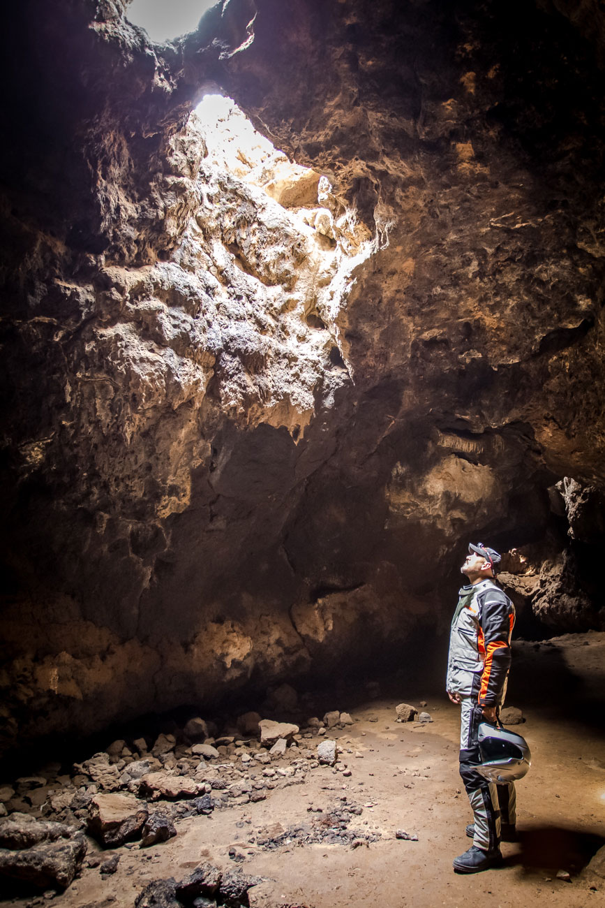

A metal staircase enables visitors to safely descend into the lava tube. Watch your head near the entrance and remember to bring a flashlight because the cave starts out very dark. Once the cave opens up, it is well lit and the cool air makes for a nice retreat from the desert heat. .
7. Cinder Cone Lava Beds
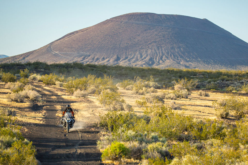
The area to the West of Aiken Mine is home to a dozens of well-preserved cinder cones and lava flows. Aiken Mine road offers spectacular views of several tightly clustered volcanic cinder cones that rise as high as 500 feet from the ground. Some were created by volcanic activity millions of years ago, while others may have been active as recently as 10,000 years ago. The youngest of the cinder cones are less eroded and have an iconic volcano shape.
Unlike some volcanoes that erupt or explode, cinder cones spew out tiny chunks of lava (cinders) into the air which slowly build up their pyramid shape. Side roads break off from Aiken Mine road and Kelbaker road allowing you to get deeper into the heart of the Cinder Cone Lava Beds for a closer look. With more time to explore, you’ll find petrified trees, petroglyphs and fossil lava falls in the area. Many of the cinder cones have trails that lead you to their cratered tops if you are interested in a hike..
8. Indian Well Petroglyphs
At the far eastern edge of the park in the Lanfair Valley is a site that’s well worth making the journey. For centuries, the Mojave Trail was a prehistoric trade route for Native Americans. Nearby the Trail, a natural well offered a place to replenish water reserves for early travelers. Today it is known as “Indian Well” or “Eagle Well” and you can still see water trickling out of the rocks even today.

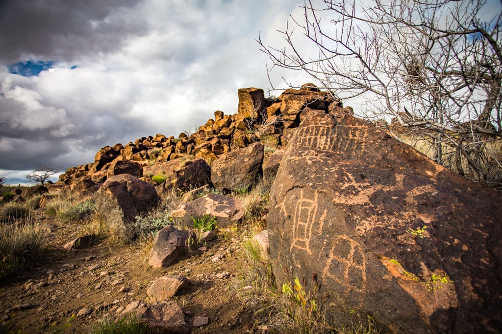
On all the rocks surrounding the well (and on nearly every rock in a 100-foot radius), native people carved a variety of different petroglyphs. Their true meanings are lost to time but some are thought to be at least 1,500 years old. In all, there are between 500-600 exquisite petroglyphs at the site. Carvings come from the Chemehuevi and Mohave tribes and possibly others that inhabited the land before them. A few inscriptions from early Euro-American settlers that visited the site can also be found among the petroglyphs..
9. Hole-in-the-Wall
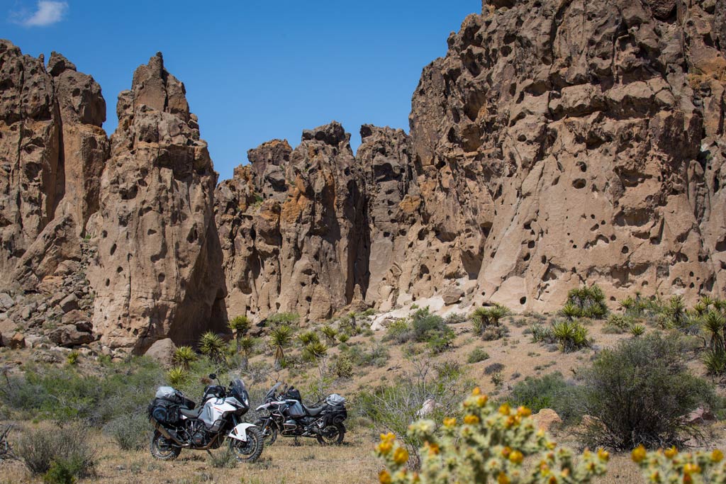
The volcanic rock formation known as Hole-in-the-Wall is actually a set of pockmarked cliffs located in the center of the Mojave National Preserve. Hole-in-the-Wall was created millions of years ago when nearby volcanic eruptions spewed out layers of lava and ash. As the ash cooled and the gas dissipated, depressions were left behind in the rock walls. Over the ages, wind and water further eroded the holes giving the hillsides a Swiss cheese-like appearance.
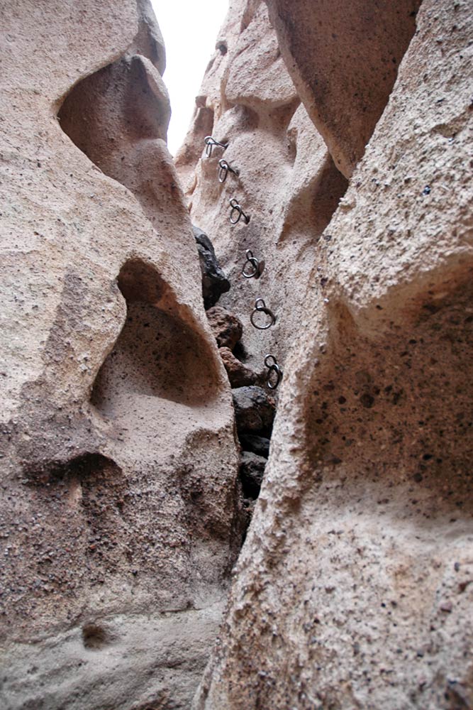
Also at Hole-in-the-Wall, is a 1.5-mile hiking trail called the “Rings Trail” that allows visitors to get deep into Banshee Canyon to experience the unique rock formations up close. Rings bolted into the rocks provide firm hand and foot holds for climbing. Legend has it that Native Americans would elude their pursuers by scurrying down these same cliffs, disappearing from view..
10. Kelso Dunes
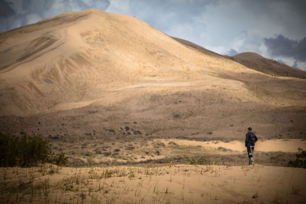
Along the southwestern edge of the Mojave National Preserve are the Kelso Dunes. Covering 45 square miles and rising nearly 700 feet above the desert floor, they are among the tallest and most extensive dune fields in the United States. Kelso Dunes were created over the course of 25,000 years as sand grains carried on the wind accumulated at the foot of the Granite and Providence Mountains.
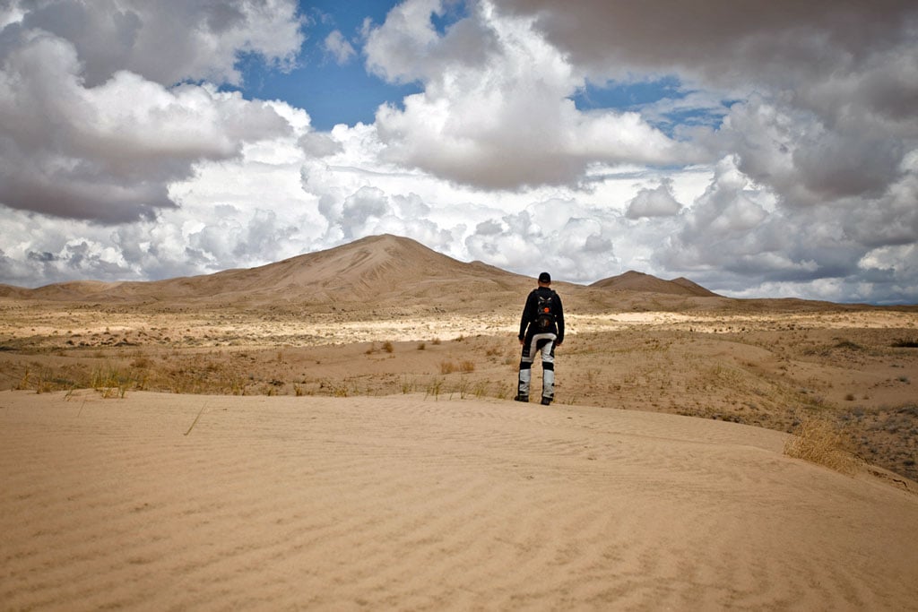
Kelso Dunes are closed off to vehicles, but visitors can hike them. It takes about an hour to hike the three mile trail up to the highest dune. At the top, the 360-degree view of a sea of sand and mountains off in the distance is breathtaking. But the best part is coming down. The Kelso Dunes are known to produce a “booming” or “singing” sound when you slide or run down the steep slopes. This acoustic phenomenon sounds like a low-frequency rumble and only occurs when the sand has the right moisture content.
Watch: ADV Weekend In The Mojave
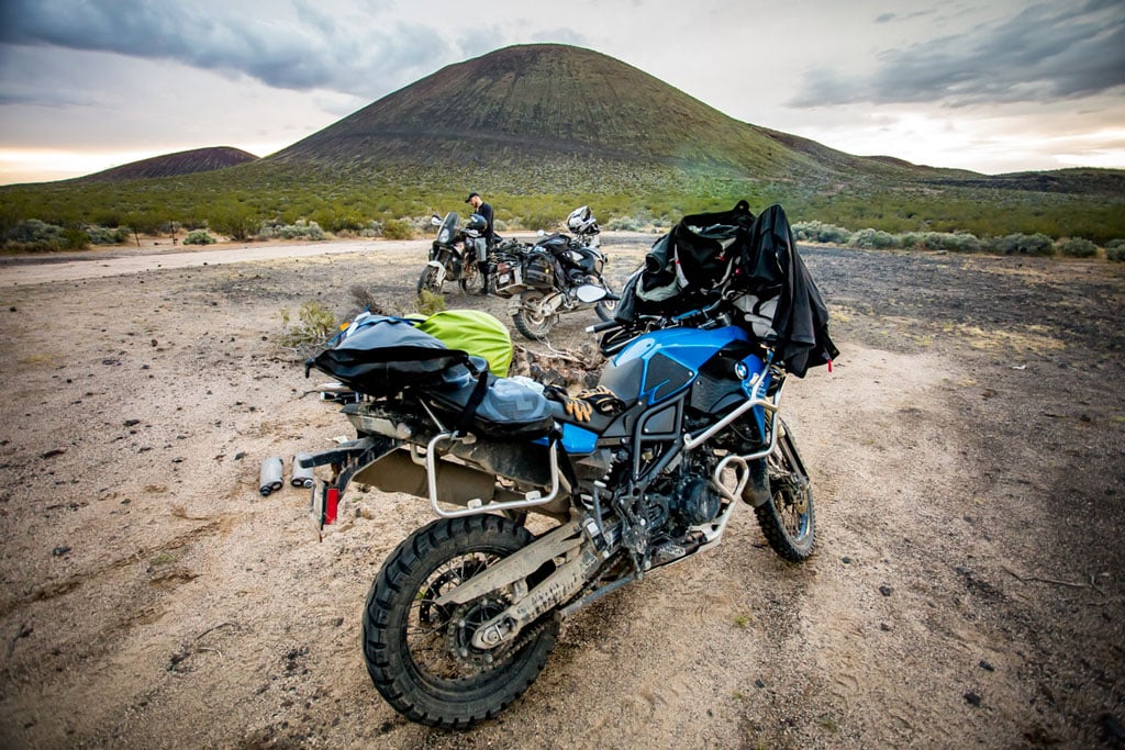
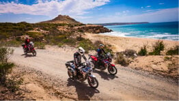
When powersports accessories manufacturer Trail Tech asked us if we had any ideas for a spot in Southern California to ride and film a new episode of their ‘ADV Weekend’ video series, the Mojave Preserve was at the top of our list and we jumped at the opportunity to play Trail Boss for the trip. The main goal of the series is to demonstrate how anyone can easily create their own amazing adventure within the confines of a three-day weekend. Check out all the action and spectacular spots we visited during the journey, much of which was based on this ride guide!
Planning Your Trip
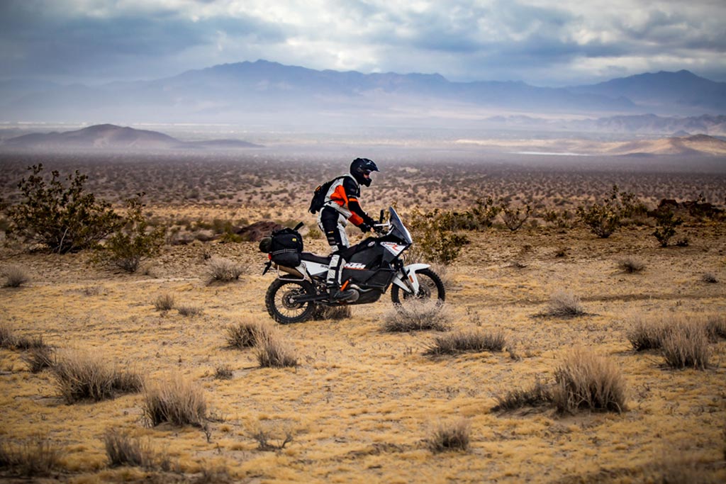
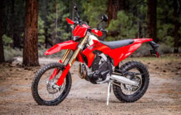
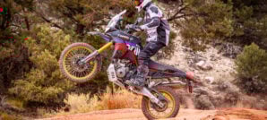
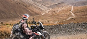
Riding Terrain: While many of the sites listed in this guide may be accessed on graded dirt roads, some require riding technical terrain, including sections of deep sand and rocky hill climbs. All sites are accessible to large 1000cc+ adventure bikes but at least an intermediate level of off-road riding experience is recommended. If you plan to visit all the sites listed in this guide, make sure you have good off-road protection for your body and your bike. A set of dual sport knobby tires, soft luggage and a fuel capacity of at least 200 miles are also advisable. There is no gas within the Mojave National Preserve, so be sure to fill up prior to entering the park. You’ll be riding through very remote areas for three to four days, so bring friends along, enough food and water, first aid and an emergency GPS messaging device.
Weather: Spring and Fall are the best times to visit the Mojave National Preserve. Winter is comfortable in the daytime but it can get down to freezing temperatures at night. Temperatures soar above 100°F (38°C) regularly during the summer. Elevations can range from 1,000 feet to 5,000 feet, so be prepared for a wide range of temperatures and wear good breathable riding gear that can handle swings in the weather. Check road and weather conditions before your departure.
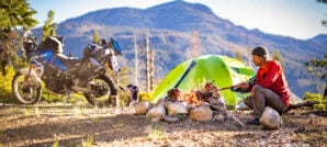
Camping: The Mojave National Preserve camping is excellent. Opportunities for backcountry camping are prevalent and it’s a great place for stargazing at night. Two developed campgrounds — Mid Hills and Hole-in-the-Wall — come equipped with vault toilets, trash receptacles, water, fire rings and picnic tables. Both are available on a first-come, first-served basis for $12 per night.
.
Gear We Used
While exploring the Mojave National Preserve, we were hit with one of the biggest storms in decades. The mud, sand and moisture really put our gear to the test. Here are some of the products we rode with that impressed us.


You can read more about how these products performed during our expedition, on our Instagram Page.
Map and GPS Tracks
We’ve put together a route that will allow you to visit all of the places listed in this Ride Guide during a 2- to 4-day trip. Full route details, GPS tracks and a larger interactive map are available on for free. With the REVER app you can load our GPS tracks and maps onto your smartphone, then use them off-line (no cell reception required). You may also * to use on a dedicated GPS device. A paper map is always good to have as a backup as well.
* Terms of Use: Should you decide to explore a route that is published on ADV Pulse, you assume the risk of any resulting injury, loss or damage suffered as a result. The route descriptions, maps and GPS tracks provided are simply a planning resource to be used as a point of inspiration in conjunction with your own due diligence. It is your responsibility to evaluate the route accuracy as well as the current condition of trails and roads, your vehicle readiness, personal fitness and local weather when independently determining whether to use or adapt any of the information provided here.
Author: Rob Dabney
Rob Dabney started a lifelong obsession with motorcycles at the age of 15 when he purchased his first bike – a 1982 Honda MB5. Through his 20’s and 30’s he competed in off-road desert races, including the Baja 250, 500 and 1000. Eventually, his proclivity for exploration led him to dual sport and adventure riding. Rob’s never-ending quest to discover what’s around the next bend has taken him on Adventures in Latin America, Africa, Europe, Asia, and throughout the American West. As a moto journalist, he enjoys inspiring others to seek adventure across horizons both near and far.
Related Stories
Related Stories
 8 Great Reasons to Ride California’s Giant Sequoia Forests 5. Getting Away From It All The extensive alpine woodland of the Sequoia...
 12 Unforgettable Spots to Explore on a Southwest Utah Ride 6. Grosvenor Arch. Grosvenor Arch is a unique masterpiece of nature. Just off...
 LA2AZ: Off-Road From LA’s Urban Sprawl To The Border of Arizona We’ve all heard of the legendary ‘LA-Barstow to Vegas’ (LAB2V) which occurs Thanksgiving...
Popular Stories

Why I Chose A 1980's Honda Trail CT110 As My Next Adventure Bike
Well, I finally bought one. After years of eyeing...
Sena Launches Their First Dual Sport Helmet
Sena is expanding its smart‑helmet lineup again...
Ducati Announces Specs & Pricing Of Street-Legal 450 Enduro Model
Ducati has officially unveiled the Desmo450 EDS...
Honda Debuts Adventure Motorcycle Film On Streaming Platforms
Honda is bringing its flagship adventure‑tourin...
Notify me of new posts via email
Great article! Bookmarking!
Thanks Nate! Hope you get a chance to ride it some time soon!
Rode there once and loved it but didn’t know I had missed so many places. I’ll have to come back and do this!
Yes, there are a lot of interesting spots in this park. One of them that is missing from the list is Mitchell Caverns. They are one of the most impressive cave systems in California but were closed in 2009 due to Federal Budget cuts. Fortunately, they have been hard at work remodeling the facilities and Mitchell Caverns is expected to reopen soon! Keep an eye out here for news about it:
http://www.parks.ca.gov/?page_id=615
Good article with lots of helpful information.
But going to the link to download the map takes me to a pay wall. Apparently one must have to sign up for a $59.99 year membership to get it. ugh!
Hi Stephen. Registering a new account on REVER is free and you don’t need to pay anything to download the tracks. If you are registering for the first time, it asks if you’d like to upgrade to a premium account. Upgrading is not required! Just go back to our story and click the download map link again after completing registration, then login with your new account and it should take you directly to the map download page.
Tried link as suggested. Doesn’t connect
It worked for me!
Rob, I think a paid (59.99 yearly 0r 5.99 monthly) premium membership is needed to download GPX tracks. I’m unable to the tracks for this ride. I copied this from the FAQ section from the Rever site under the Support tab:
How do I get rides from Rever onto GPS devices like my Garmin?
This is a Premium Feature but it’s super easy. Just click the button on the ride detail page that says ‘Download GPX’. This will turn your ride into a .gpx file that you can download to your computer. From there you’ll need to plug in your GPS device and transfer the .gpx file to it. You may need to use Garmin Basecamp or MapSource to do this if you have a Garmin.
Hi Kenny. Looks like you are correct that a premium membership is required to download the GPX file from REVER (for use on dedicated GPS devices). Sorry for the confusion on this. However, users of the ‘free’ version can still download the ride and navigate our tracks using their Smartphone. We have updated the link so that you can download the GPX file directly from our page. Thanks for the heads up!
Thanks for the new link. Access to the GPX file now works. Looking at it on Garmin Basecamp, it looks like it should be a good ride.
BTW: I have posted some of my own rides including GPS tracks, photos, and video here: http://www.stephenfischerphotography.com/Motorcycle/motorcycle_corner.html
Looks like some great rides you’ve got there as well Stephen. Thanks for sharing!
Great article. Thanks. Is the same route accessible (legally and technically) by 4WD if I want to make it a family camping trip rather than riding it on the GS with the guys? Is any of the terrain too technical for a stock Jeep or similar, unmodified 4WD? I would guess it wouldn’t be too technical tough if the terrain is accessible by GS with moderate riding skill.
Hey Evan. There are a few tough spots but a stock 4×4 should be able to handle it.
Thank You for sharing. Time to start planning my ride!
Thank you Jesse. Hope you enjoy the riding as much as we did!
[…] if you ride with friends that too-often forget to top off before departing, or you are regularly exploring new areas where the mileage from point A to point B can be unpredictable, it’s nice to have some fuel to […]
[…] highway days, scraped pegs on California’s Highway 2, stormed through deep sand in the Mojave Desert, traversed slick rock in Moab and climbed rugged mountain passes in Colorado. We’ve pushed the […]
great article!! my friend and I are going to do this ride (starting in the SF bay area) at the end of april. I’m a rever user but would like to get thetracks on my garmin aswell, but when I click the “download GPX files here” link it sends me to a blank page. any ideas?
Hi Jeff. Thanks for the kind words. Just tested the download of the gpx file and it seems to be working. Give it another try and see if it’s works for you now. Have a great trip!
I’m really gearing up for this ride now. I think the bike, gear and myself are just about done with prep! One thing I’m worried about, tires! I did some pretty serious mud riding with my scorpions this weekend and while they’re great on the road or in hard packed they suck in the mud. What were you guys running for tires??
Hi Jeff.
We ran Michelin Anakee Wild Tires. They are a true 50/50 dual sport tire that work great in the sand or mud. More details here:
https://www.advpulse.com/adv-products/michelin-anakee-wild-review/
Ok thanks. That’s not going to work for me. I’m running 21 front / 18 rear
The Kenda Big Block, Continental TKC 80 or Metzler Karoo 3 are all good choices in the 50/50 category for 21/18 wheel combo. Michelin should be coming out with new sizes in the Anakee Wild very soon.
[…] Los Angeles to Mormon Lake, Arizona for the Overland Expo in a single day. A ride that would take three days to return the hard […]
This is a great resource for our event May 4-6. Thanks!
I was hoping to download these GPX files but I am also getting forced to pay for a REVER membership. I also tried to export the data from the google map but was unable to do so.
Just look for the link at the bottom of the article where it says… “You may also download the GPX file here*” and you can download the file directly without going through REVER.