Snow, Rain & Sand: Riding Death Valley’s Toughest Trails
Attempting the valley’s harshest terrain at the tail end of a 100-year storm.
“You’re not planning to take those bikes out in this weather, are you?”
Sometimes, the wisdom of strangers in the desert carries more weight than all of the forecasting tools available to city-dwellers. At a fuel stop in Mojave, CA the older gentleman who approached and kindly posed this question had the appearance and gait of someone who might not presently ride motorcycles, but seemed to have a lot of experience in the desert.
My answer to this stranger’s question was a simple, “That’s the plan.”
The skies had opened up as we were leaving LA, and the storm continued all the way to Panamint Springs. Brief pauses in the downpour were insignificant at best, as record-breaking rain in Death Valley continued throughout the night and into the following day, with snow falling simultaneously at higher elevations.
Waking to a winter wonderland out of some Western film that was never made meant plans had to change, and they did, sort of. Day one of this project was supposed to have gone straight up Highway 190 to the entrance of Saline Valley Road, and off into the northwestern portion of Death Valley. Relying on a weather report for an area larger than some U.S. states with a year-round population of exactly zero is sketchy at best. Fortunately, we had better information than any digital platform could provide, as our photographer and lifetime desert explorer, Ely Woody, had driven past our intended route entrance earlier the same morning we were planning to depart.
Over breakfast at Panamint Springs Restaurant, “It’s snowing there, right now,” was the succinct quote, to the best of my recollection. As this plan to hit all of Death Valley’s Toughest Trails was essentially a cloverleaf tour from a central hub in Panamint Springs, we opted to aim for one of the lower elevation loops first, holding out hope that the higher elevation weather might be more favorable sometime over the next 24 hours. We learned being half right is better than nothing.
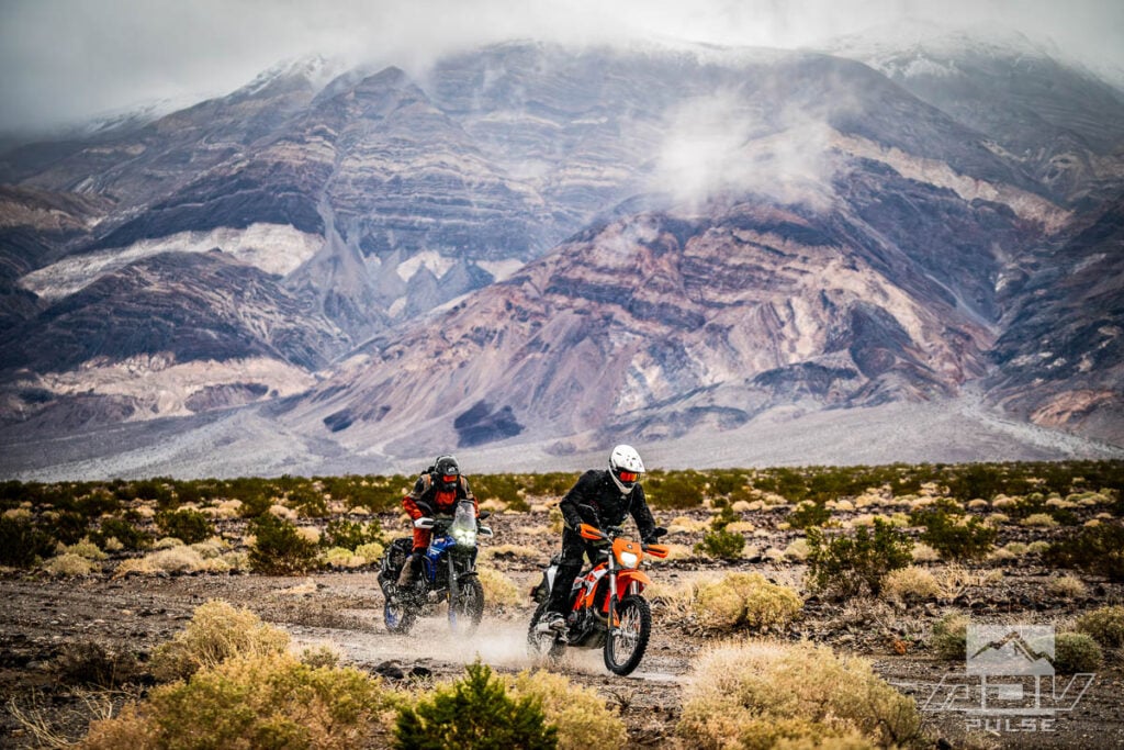
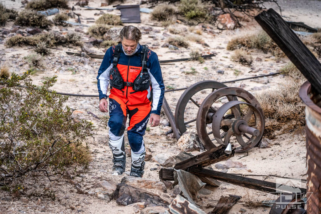
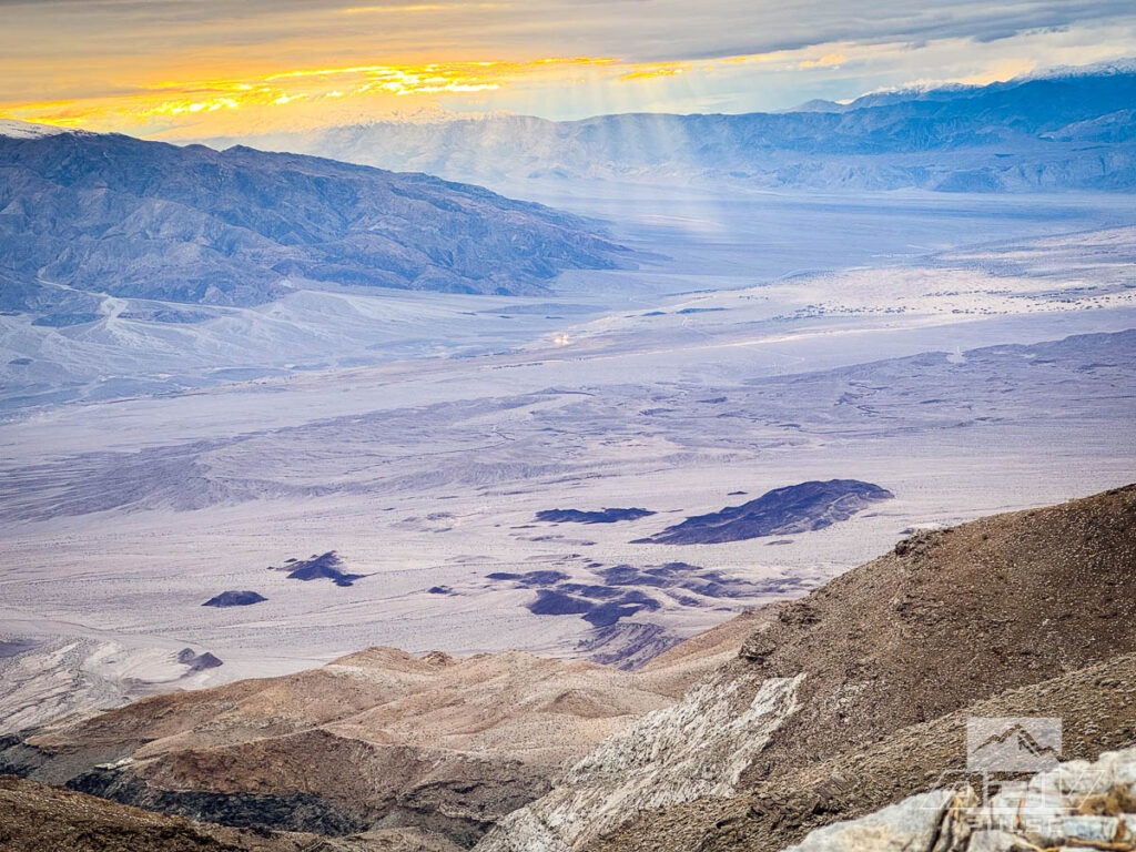
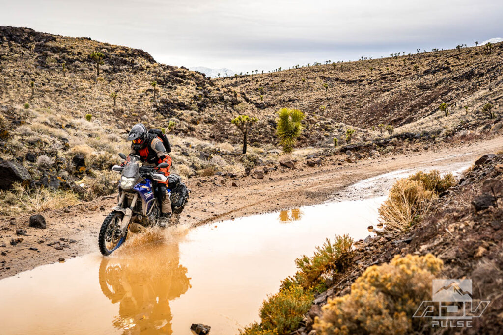
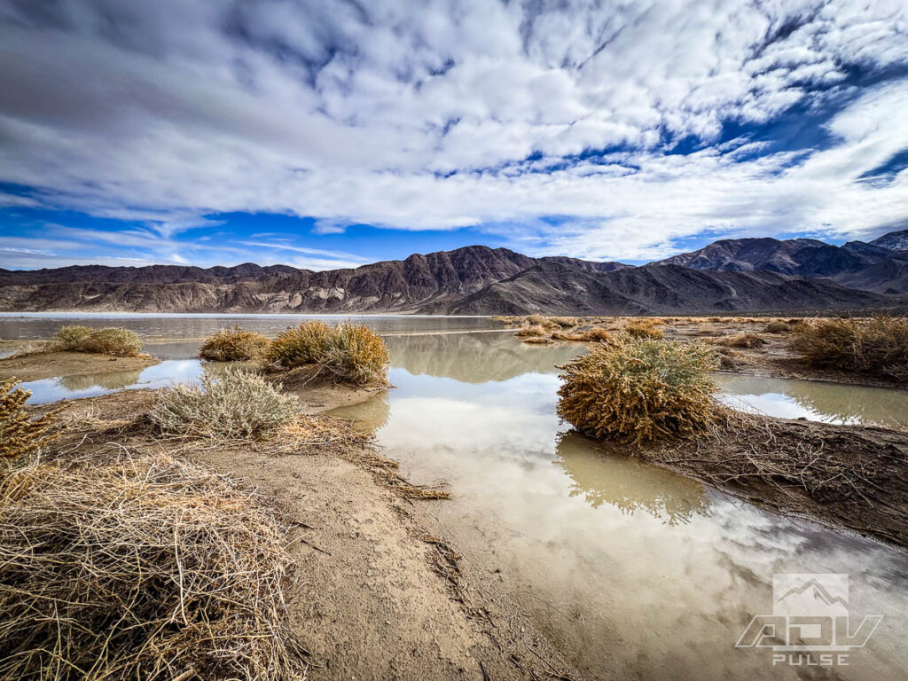
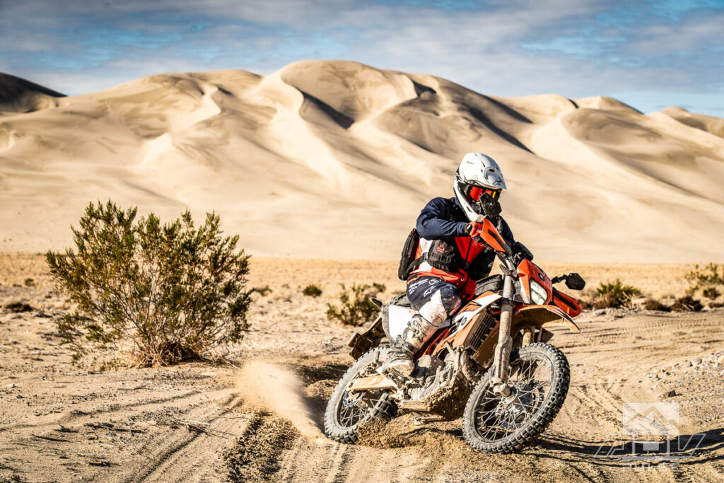
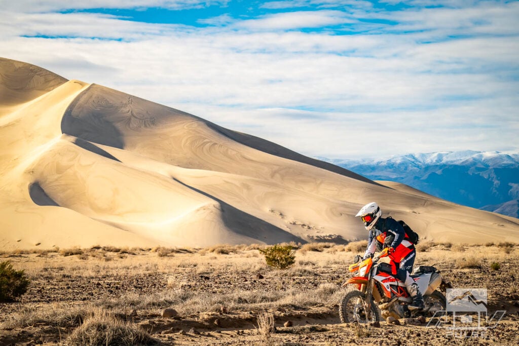
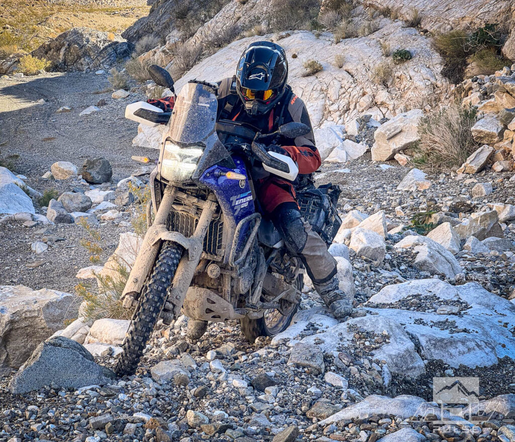
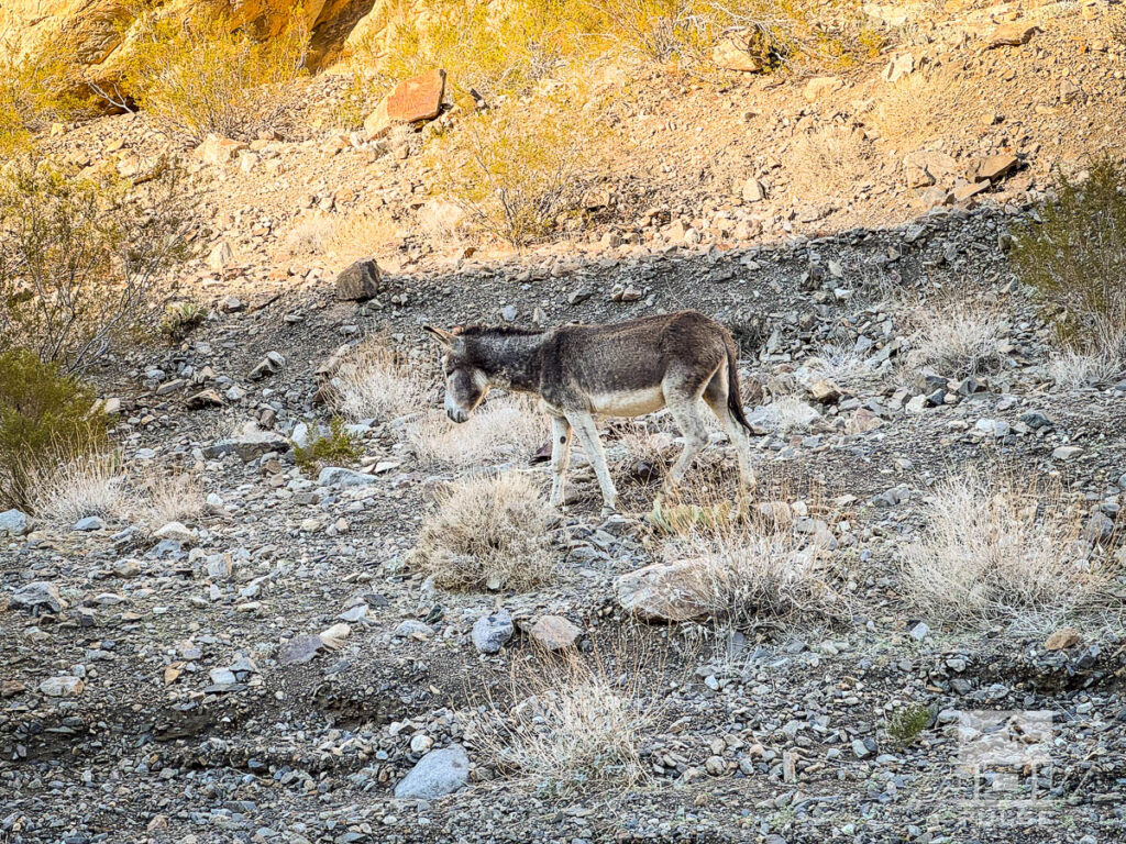
A brief pause in the morning rain provided just the right amount of false hope that skies would remain clear, and we headed out. Death Valley is a region of endless vistas where even the most boring landscapes it has to offer are beyond imagination for those who have not visited here. Our first photo stop felt like a stone’s throw away from basecamp. Granted, 10-plus mile visibility makes most anyplace feel like a stone’s throw away. People have died here trying to walk to “that mountain right there.” We weren’t on the bikes very long before we stopped for some photos in the extremely rare wet, muddy, and snowy landscapes of this normally parched land.
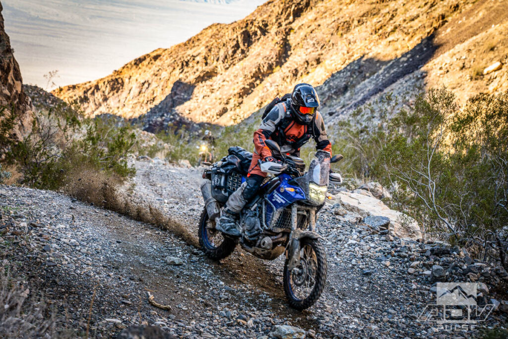
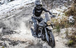
After being encouraged by the lack of rain even under gray skies, we got on the tarmac to burn some miles to an intended trailhead, and Death Valley again reminded us who’s boss. Blinding rain, rivers of debris flowing over established highways, freezing temperatures in the hottest place on earth… I was running Alpinestars’ highly vented Pro Dura gear, which is easily some of the most well-designed enduro gear I’ve tried, however in these conditions it wasn’t the optimal choice. This Pro Dura gear would arguably become the best choice among our group a couple days later, but not before it became the worst. Welcome to the unpredictability of Death Valley.
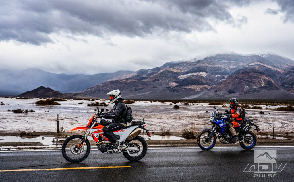
Visibility over Towne Pass bordered on zero. Frozen hands and soaked feet wouldn’t experience any relief for over 40 miles until we reached relatively clear skies at Furnace Creek. Pausing for fuel and thawing, we would fortunately get off the highway and into one of the more technical routes of the trip just a few miles away from the fuel station.
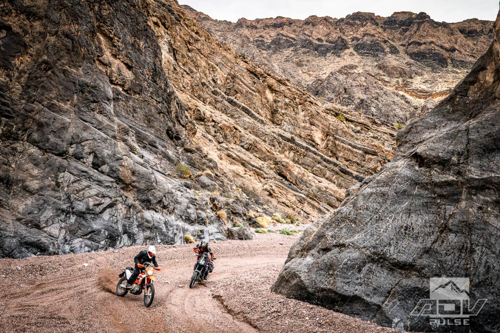
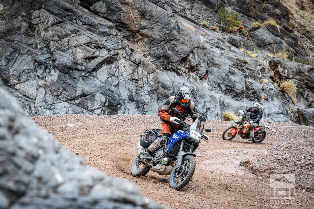

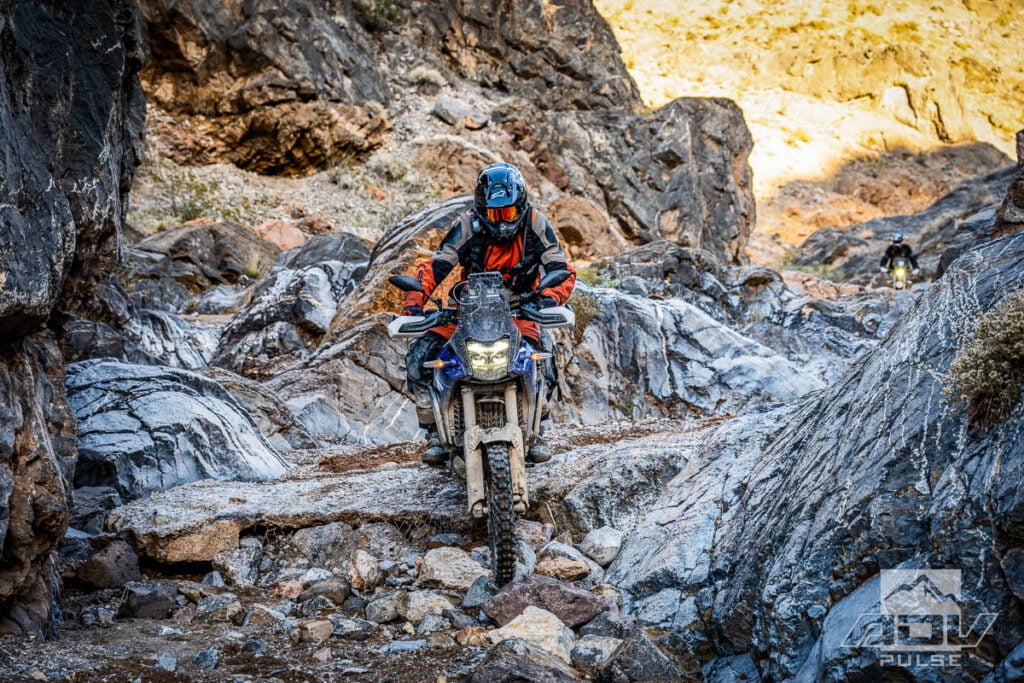
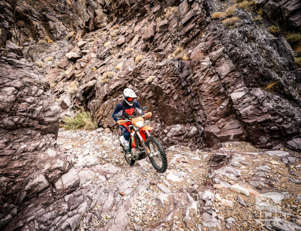
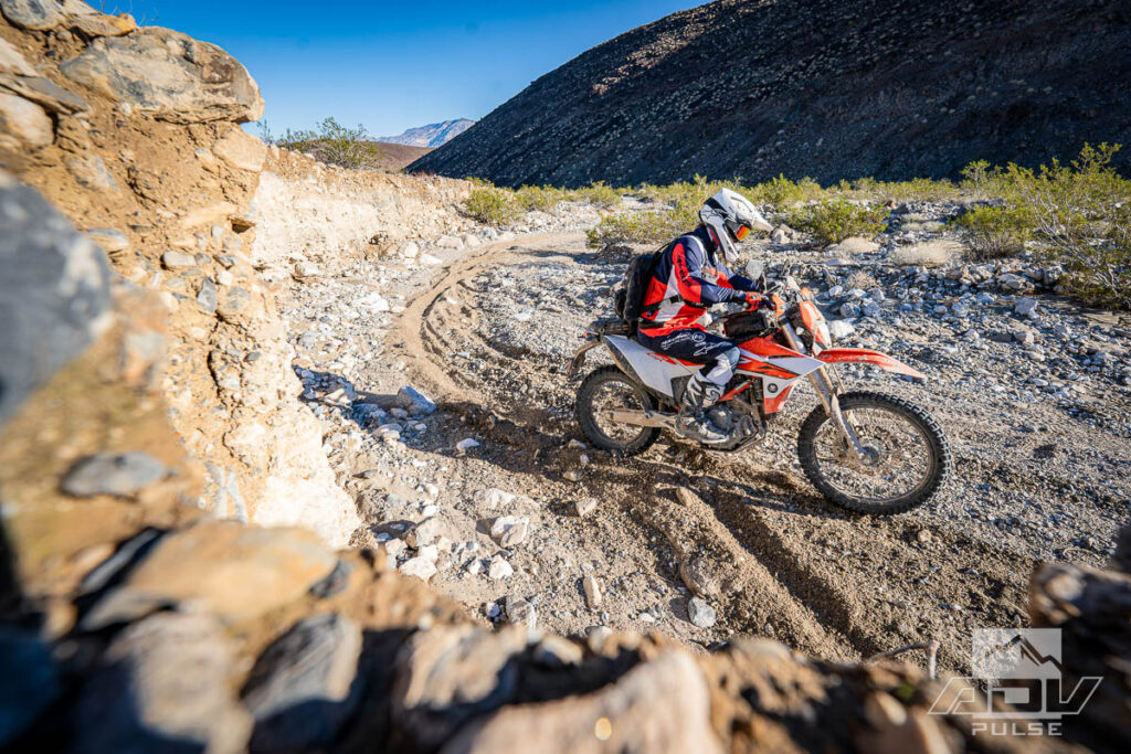
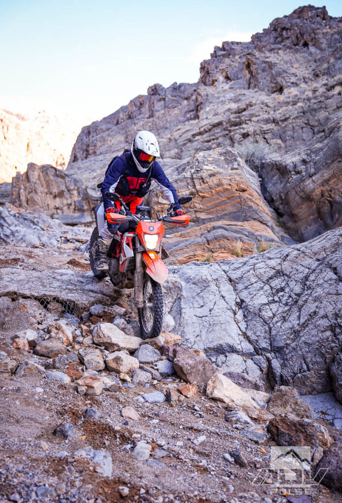
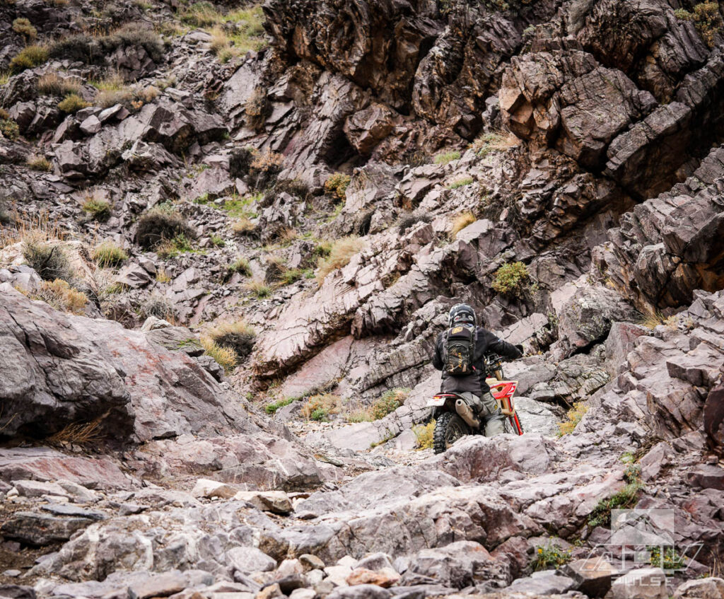
For the most part, Echo Canyon is a very easy and rewardingly scenic route. The few “gatekeeper” sections are what separates this route from the typical fare of liter-plus adventure bike riders. Echo Canyon could be compared to another, perhaps more well-known Death Valley trail, Goler Wash. I’ve ridden a few big twin adventure bikes up and down the “waterfall” in Goler wash, both before and after the rocks were stacked there to aid four-wheel vehicles.

In Echo Canyon, after several miles of deceivingly mellow rocky sand wash, the first obstacle encountered there makes the Goler Wash waterfall look like a suburban driveway cut. The scattered challenges along Echo Canyon make me wonder if any of the cast or crew from 1970’s cult classic Zabriskie Point took a short detour from set and made the trek through this Canyon in their spare time. It’s honestly easier to imagine a 1970 Bridgestone 100 GP getting through this route than a 2025 BMW R 1300 GSA. An idea to be tested in a future comparison story, perhaps.

Sometimes, a tough trail can refer to difficulty in navigating as much as riding. Dropping down the mountain out of Echo Canyon, and essentially turning left before reaching Nevada, we began following a faded two-track across open desert towards the dramatic vistas of Death Valley above the long-forgotten Chloride City.
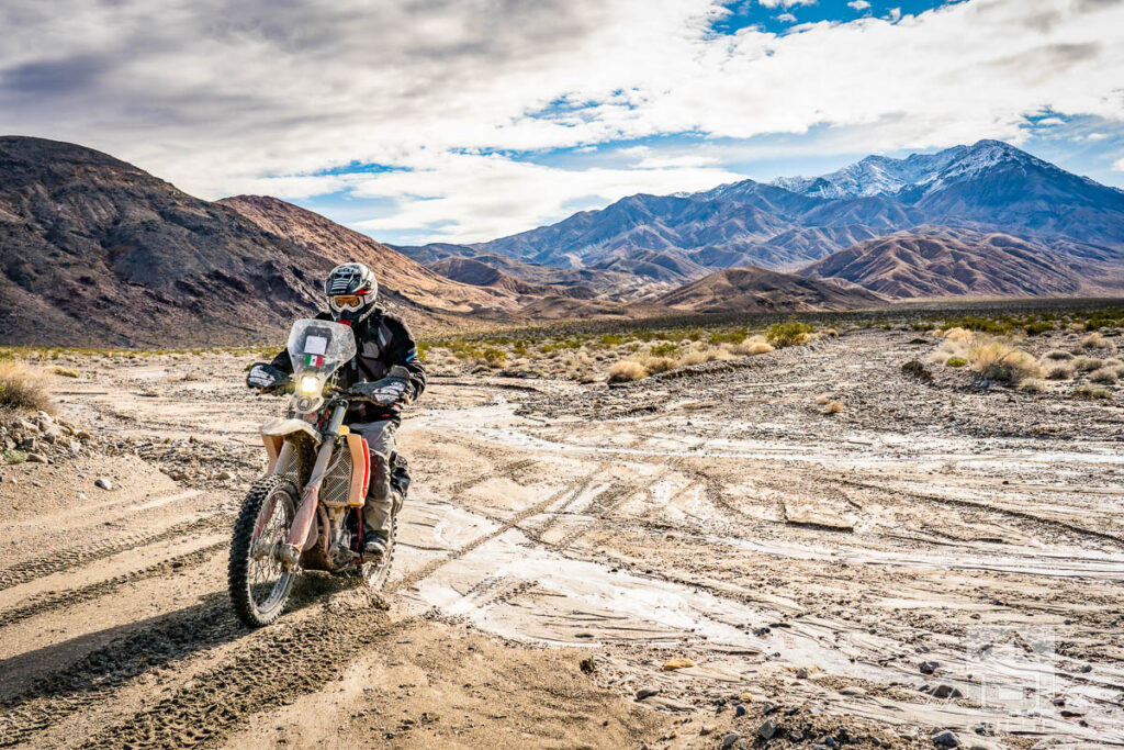
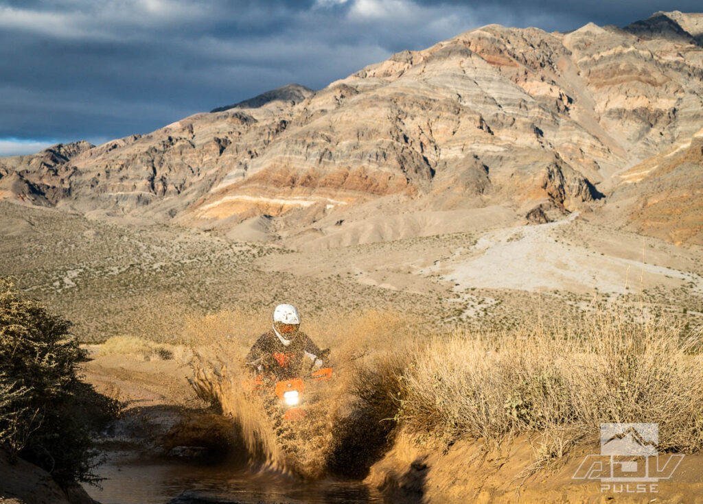
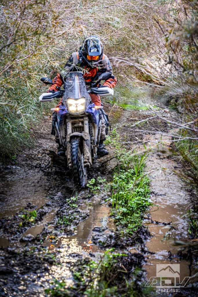
The two-track which began as a faded trail, essentially turned nonexistent at some point several miles out into open desert. While the path was uncertain, the mountains we were aiming for were clearly visible in the distance, under foreboding skies. Adding to the ominous nature of the late-hour ride through remote desert, the first relatively established dirt road we encountered seemed poised at any moment to celebrate its rare gift of significant rainfall by spawning pockets of quicksand, which threatened to suck our motorcycles down to a level where they might never be found again.


Thankfully, we floated on with only scattered moments of avoiding or navigating through quagmires on the desert floor. As we climbed the Funeral Mountains, toward the failed city of Chloride, the mud lessened and was replaced with mostly hardpack rocky trail. The views from the peaks above Chloride are easily some of the most impressive valley vistas I’ve seen anywhere. It’s awesome, but I don’t envy the travel agent tasked with writing the brochure to encourage people to visit here. “It’s a failed settlement, in the Funeral Mountains, of Death Valley.”
On day two, Death Valley provided a twist of fate that only a place like this can pack into a short adventure. One of the easiest routes, not even on our radar as a difficult region of desert, became one of the greatest challenges. This was followed almost immediately by one of the more well-known challenging routes becoming some of the easiest terrain we would encounter, by comparison.

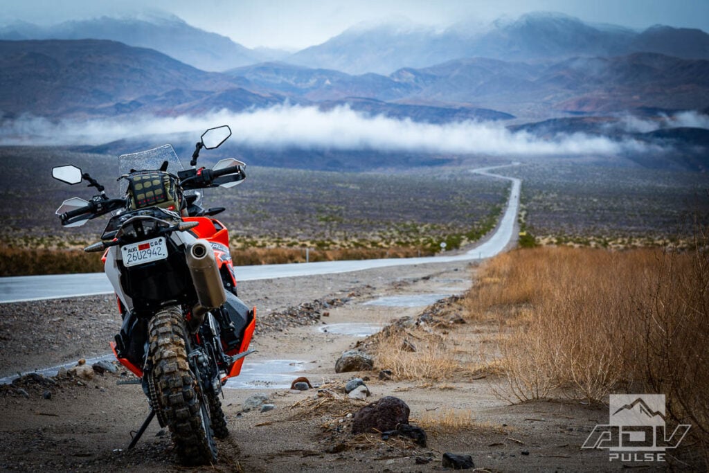
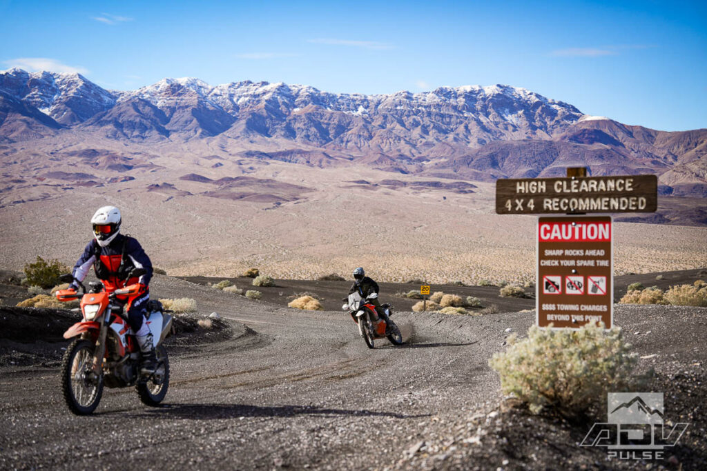
Entrances to many difficult trailheads are often discretely marked or entirely unmarked. Large road signs are sometimes a hint that less difficult routes lie ahead. The more prominent the sign, the easier the route might be. This isn’t always the case, but is true at the entrance of Saline Valley Road. This road begins as a wide and smooth gravel path at its intersection with Highway 190, and features a travel-worthy sign welcoming almost any vehicle to venture north into the remote portions of Death Valley.
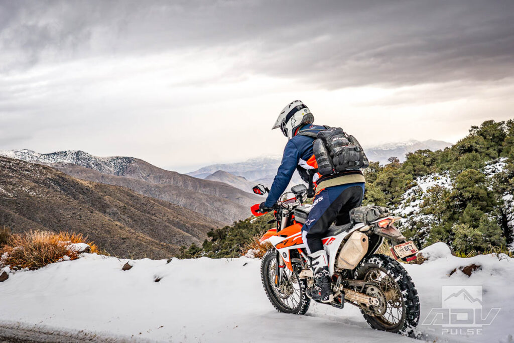
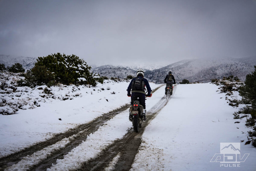
Things change when you take this same road, soak it with rain, then snow, let it freeze over, and drop it into a remote valley. Sliding down the snowy landscape from over 6,000 feet to the valley floor, two thoughts occurred: 1) getting back up this hill on Continental TKC80s, at night, in sub-freezing temperatures, could be a challenge, and 2) other exits from the valley to the north traverse passes ranging from 7,000 to over 8,000 feet, meaning they might be impassible by any vehicle in this weather.
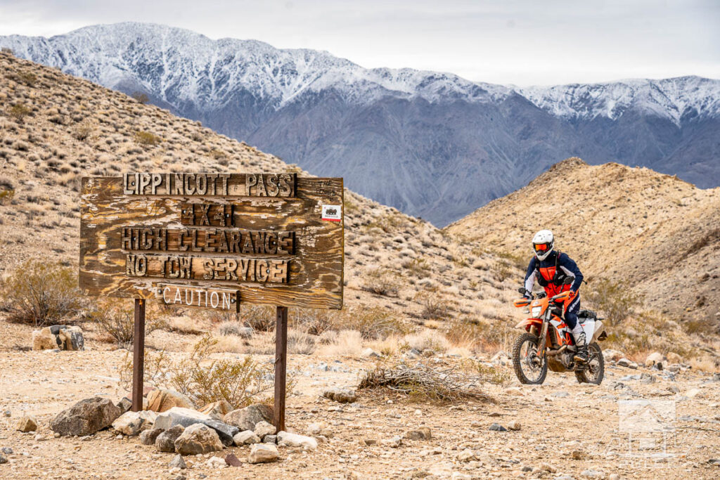
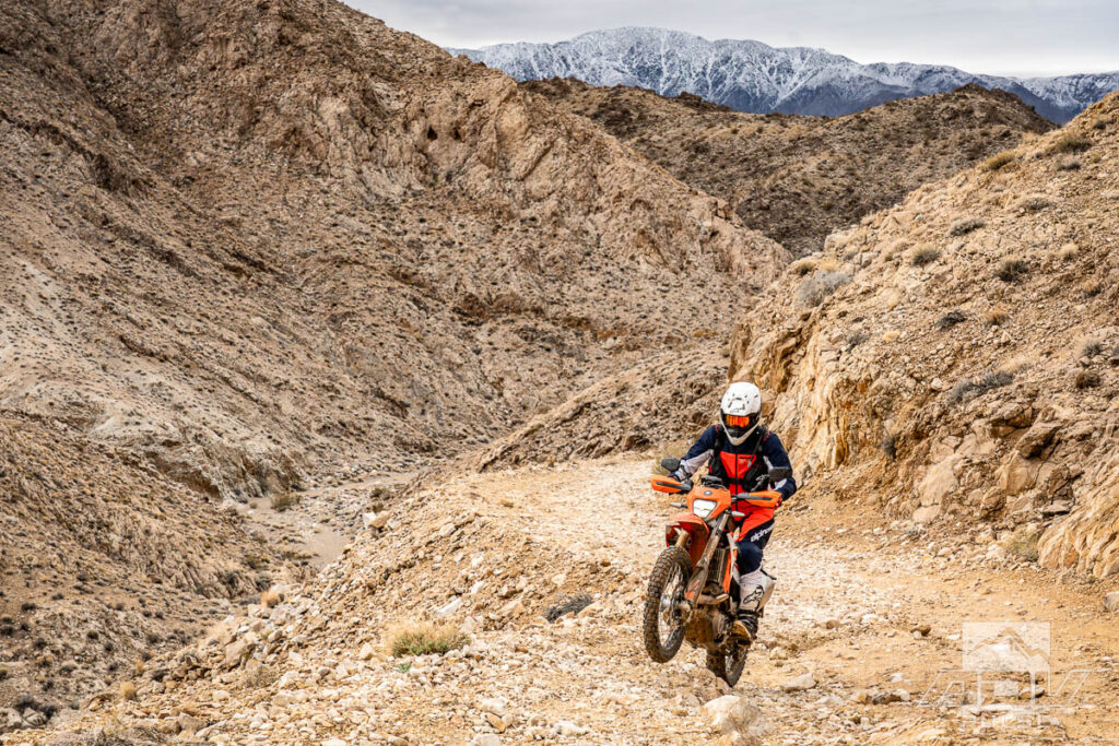
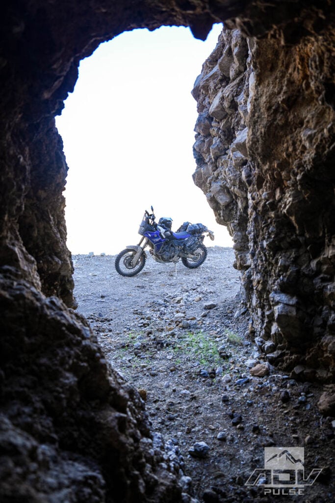
We had already planned to ascend Lippencott Pass. There are signs for this route, however unlike the more welcoming signs of Saline Valley Road, the upper entrance of Lippencott reads “LIPPENCOTT PASS – 4X4 – HIGH CLEARANCE – NO TOW SERVICE – CAUTION”. Traditionally, most people descend this route. We were going up, and were oddly surprised by the relative ease of the climb. Many of the more technical sections on the most recent descent I could recall seem to have been removed, or at least reworked, as the climb posed little to nothing in the way of challenges I recalled from past rides.
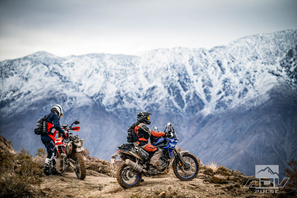
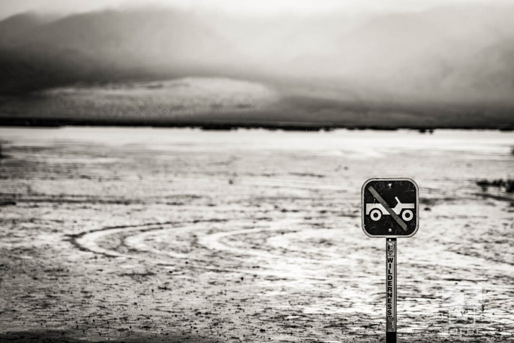
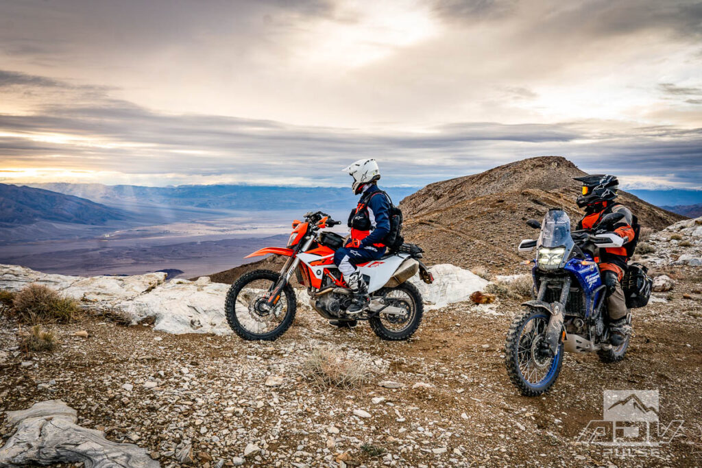
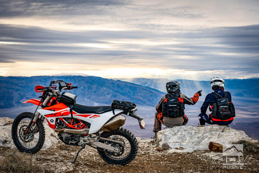
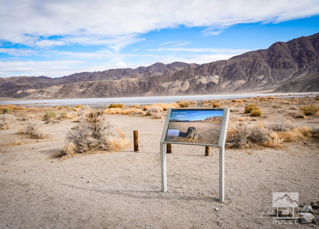
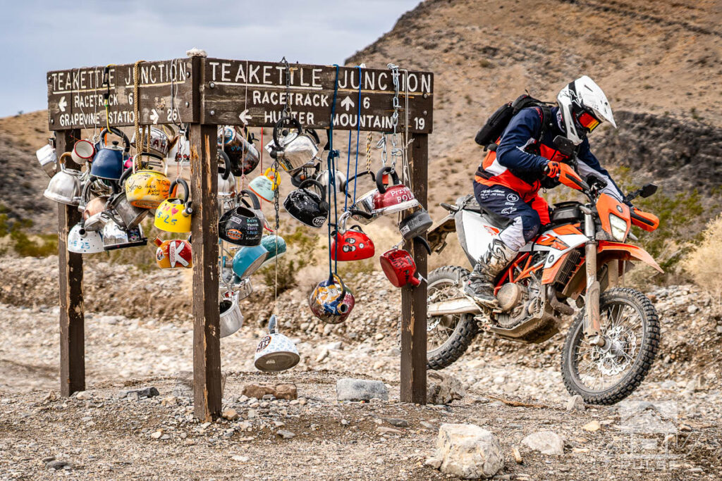
Cresting Lippencott, we encountered the first group of motorcyclists we’d seen here. Clear skies and mostly dry ground seemed the perfect environment for what appeared to be a large tour group, complete with chase truck loaded up with a spare bike. Arriving at the “Racetrack” underscored just how lucky both ourselves and this group were to be here at this time. Water had filled the playa, and while the famed sailing stones were obscured beneath its surface, this was the first time I’d ever seen The Grandstand living up to its moniker as an “island.” Normally a rock formation poking out of a dry clay surface, the large quartz monzonite outcrop now appeared to float on a massive temporary sea.

In keeping with the rare and bizarre conditions we encountered, Racetrack Valley Road between Teakettle Junction and Ubehebe Crater is normally by no means on the list of challenging routes in the desert. For the most part, it remained a very easy and fast route on this trip, for around 99% of its length. The remaining 1%, however, is what caused the only “flying W” I experienced during the trip, when one of the exceedingly rocky cuts in the road from storm damage appeared unexpectedly.
Arguably the most technical portion of the trail we encountered, was preceded by one of the most visually impressive things we saw. Death Valley’s Eureka Dunes are the tallest sand dunes in California. Riding on them is not permitted, and while a quick rip up the massive slopes seems tempting, appreciating the sight of mostly untouched desert magnificence erases any thoughts of rule-breaking here. Foot traffic is permitted, however, so you simply need to mentally erase the large bounce cards and windswept silk chiffon of whatever influencer’s photo shoot is happening during your visit.
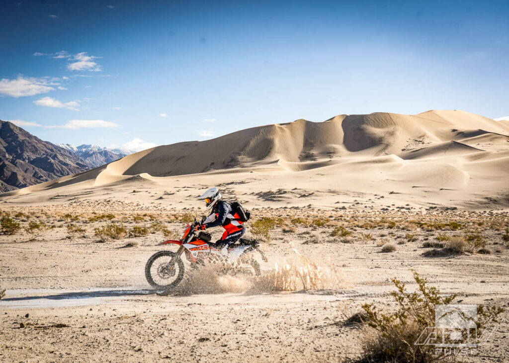
Stunning dunes, populated only by a small group influencing them, were surrounded by some of the most uniquely bizarre mud I’ve ridden through. Hardpack trails hid pockets of a quicksand compound with the look and consistency of white lithium grease. These slick spots usually ended as quickly as they began. It’s almost like the desert wants to keep you guessing here. It’s also like this desert knows how special and desirable it is to explore, as with each challenge comes a greater reward.

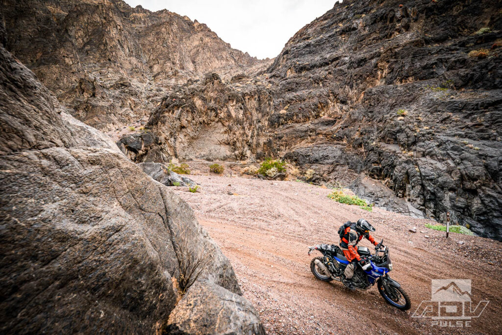
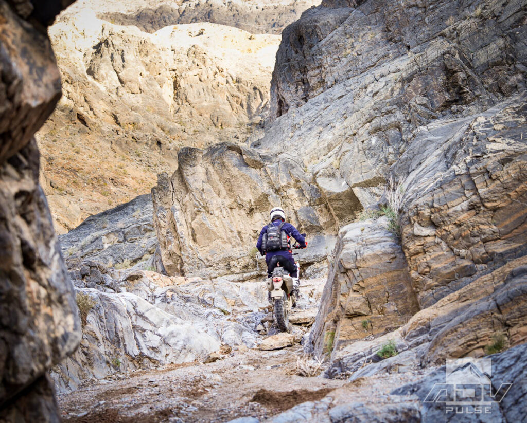
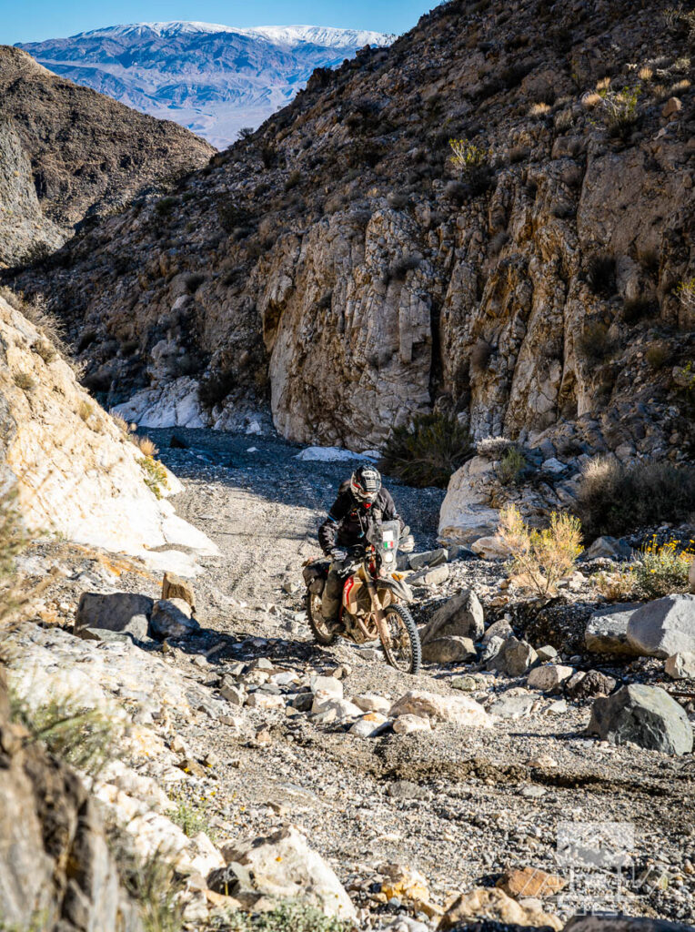
Witness the glory of the Eureka Dunes, plow through the fun sand berms and confusing mud pits surrounding them, try and navigate a dirt road through Steel Pass that was recently shuffled by a giant dealing a deck of boulders, and you can arrive at Dedeckera Canyon. Thinking back to the first surprising step up at Echo Canyon, I’d have to say Dedeckera Canyon was easier. After riding through some of the subsequent destruction we’d encountered along Death Valley’s roads, perhaps my gauge of difficulty had been re-adjusted. Regardless, both routes are fun, just pick your poison. Echo Canyon is a Herculean stone’s throw from infrastructure at Furnace Creek, while Dedeckera Canyon is the more adventurous destination, far from the nearest anything.
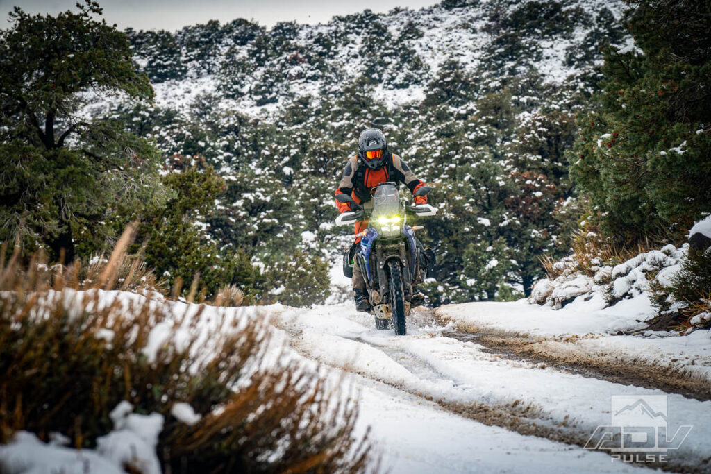
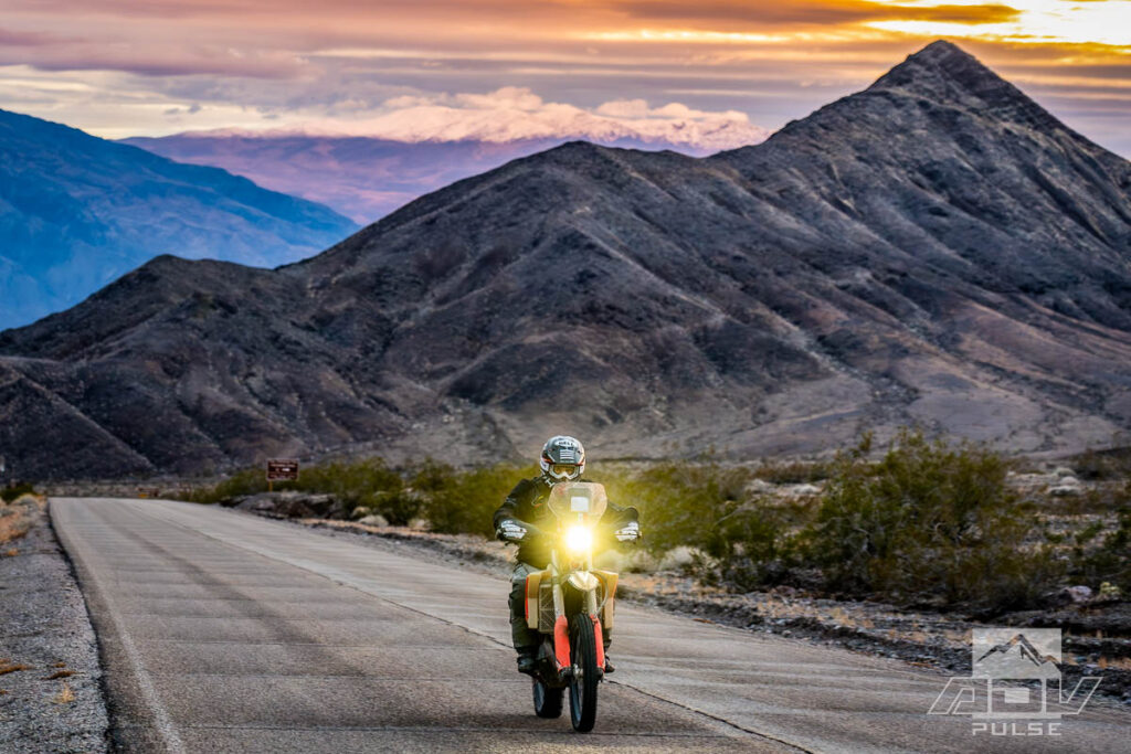
Fuel concerns emphasized just how far from the nearest anything we were. In considering options, the most reasonable choice ended up being to follow Death Valley Road to the pavement of Loretta Mine Road, and eventually connect with Highway 168 into Big Pine for fuel. It was somewhere above 7,500 feet where I was reminded the Alpinestars Pro Dura gear might not have been the best choice for this area, during this time of year. Temperatures dropped to at least 27 degrees Fahrenheit in the snow-covered passes. Less than ideal weather for burning pavement miles wearing highly-breathable enduro threads but with a thermal top underneath and my waterproof liners over top it was reasonably comfortable.
While the desert is inherently subject to intense change, some weather events are more intense than others. Case in point – Nadeau Trail. I’d ridden this trail in the past, yet could barely recognize a single portion of it this time through the boulder fields and deep washout cuts. Basically, we were creating a new trail, through a familiar valley. Navigational difficulties were perhaps understandable, given the amount of water which recently tore this desert to bits had set a new record for November Death Valley rainfall, at 1.76 inches. This amount squeaked by the previous record which had remained unbroken since 1923, when the valley saw 1.70 inches of rain in the same month.
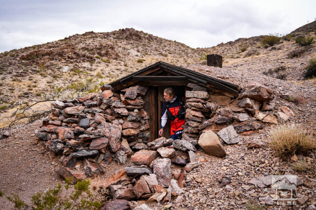
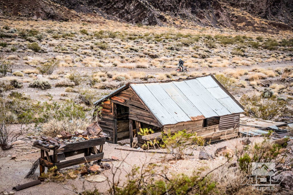
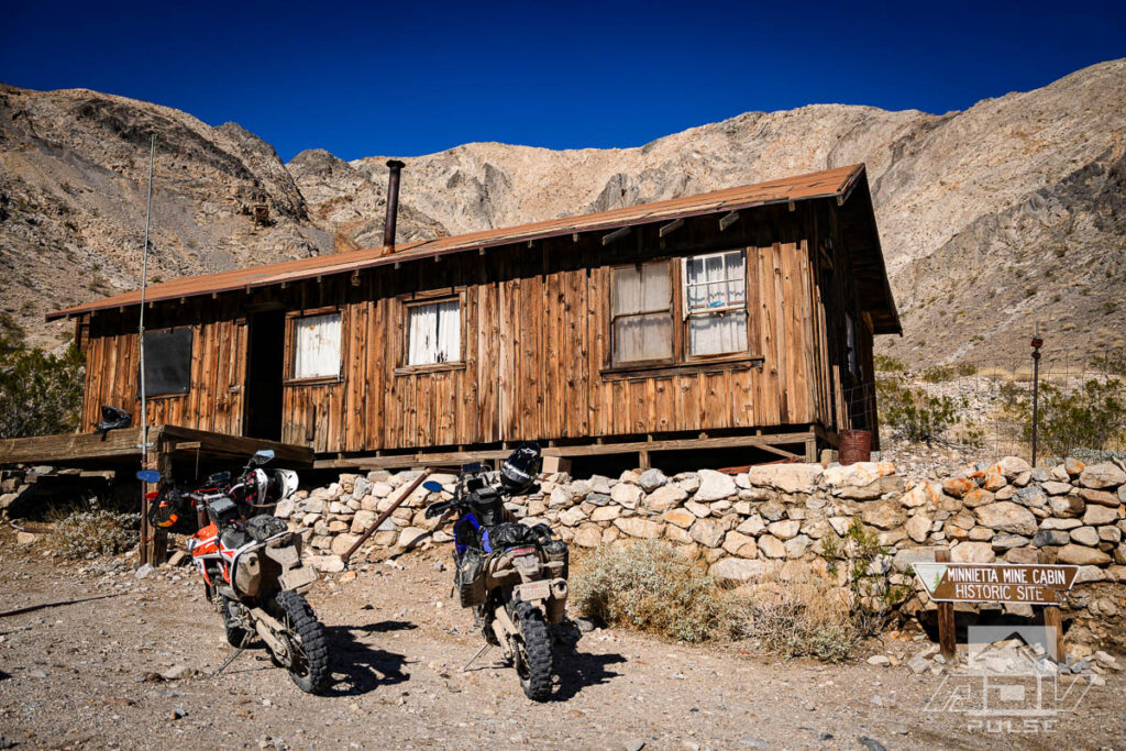
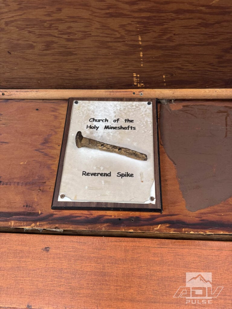
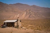
In both name and location, Lookout City is one of those desert locations that’s difficult to describe to anyone without access to serious off-road vehicles. It’s not far from the comforts of Panamint Springs, yet feels like a world away. The idea of a “city” existing where only scant remains of buildings and infrastructure remain, perched at the edge of a precarious drop to an unforgiving valley floor, begs questions of who and why.
Who were these maniacs carving out death roads through impossible terrain, and why did they do it? While the oldest profession is debatable, the concept of money has always been at its core. Once a bustling mining settlement, Lookout City is a prime example of the extremes humans will go to in order to achieve income.
Today, there is virtually nothing left at Lookout City, apart from scattered remains and unforgettable views for those willing to make the trek to the site. Compared to many sites, Lookout City has elements which give it the feeling of having been abandoned more recently. A fragment of a Coke bottle. A length of gas pipe. What appears to be someone’s cabinet in the corner of a house. Rock walls of seemingly ancient buildings here somehow still echo the sounds of stamp mills and roaring furnaces.


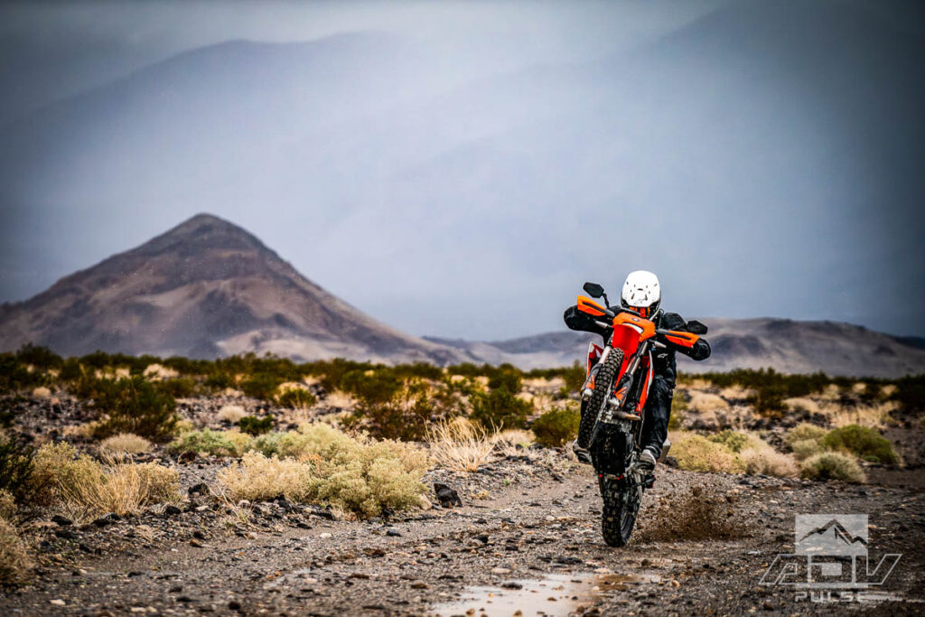
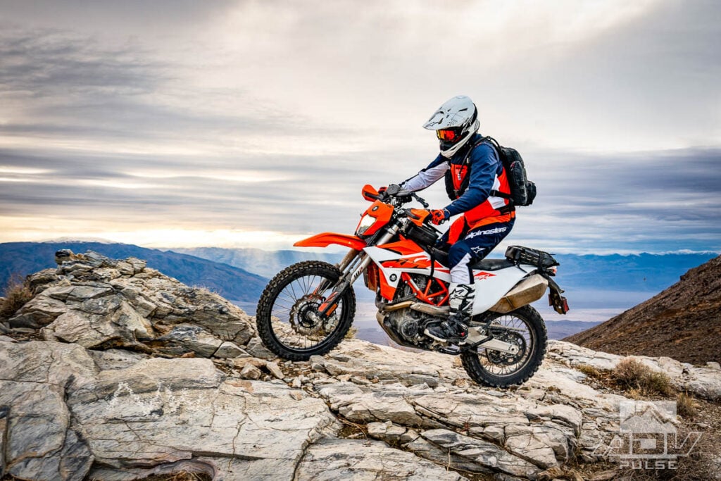
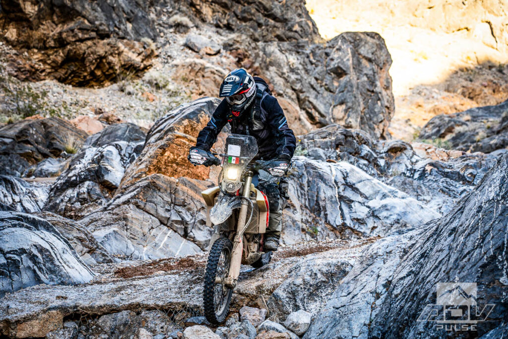
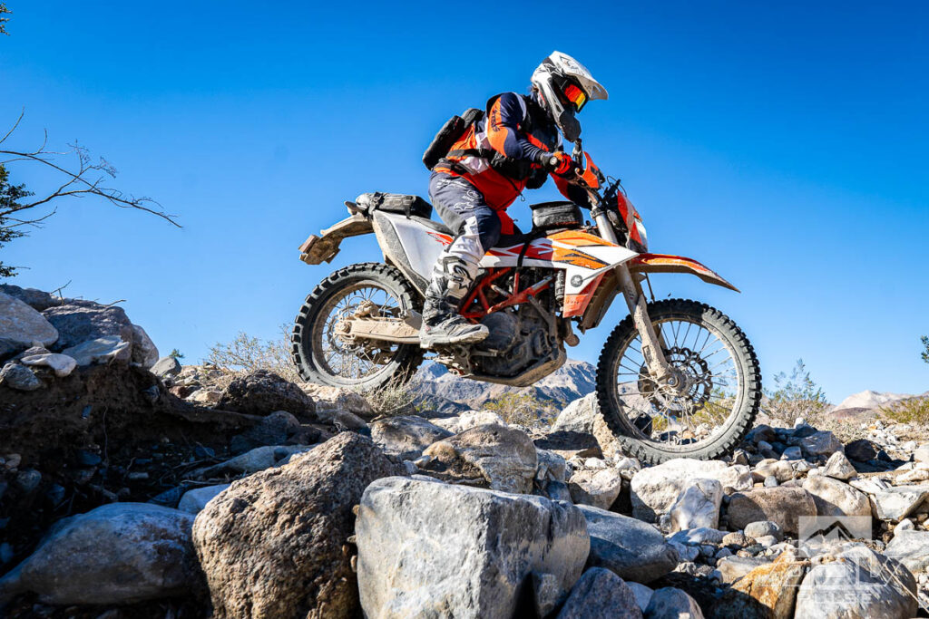
Fair warning, novice riders need not apply if you want to visit this place. It’s definitely not an overly technical ride by any means, but is proper off road terrain. Prior to the final steep climb leading to the upper plateau, the approach out of Nadeau Road involves navigating a tight and sandy uphill wash, with a couple gatekeeper-style obstacles to keep you on your toes. It was here, on day three of our trip, where the Alpinestars Pro Dura gear became the optimal choice for these conditions. Jacket sleeves came off as the temperatures finally rose to a reasonable level, and the KTM 690 Enduro R got to show off why “enduro” is part of its name.
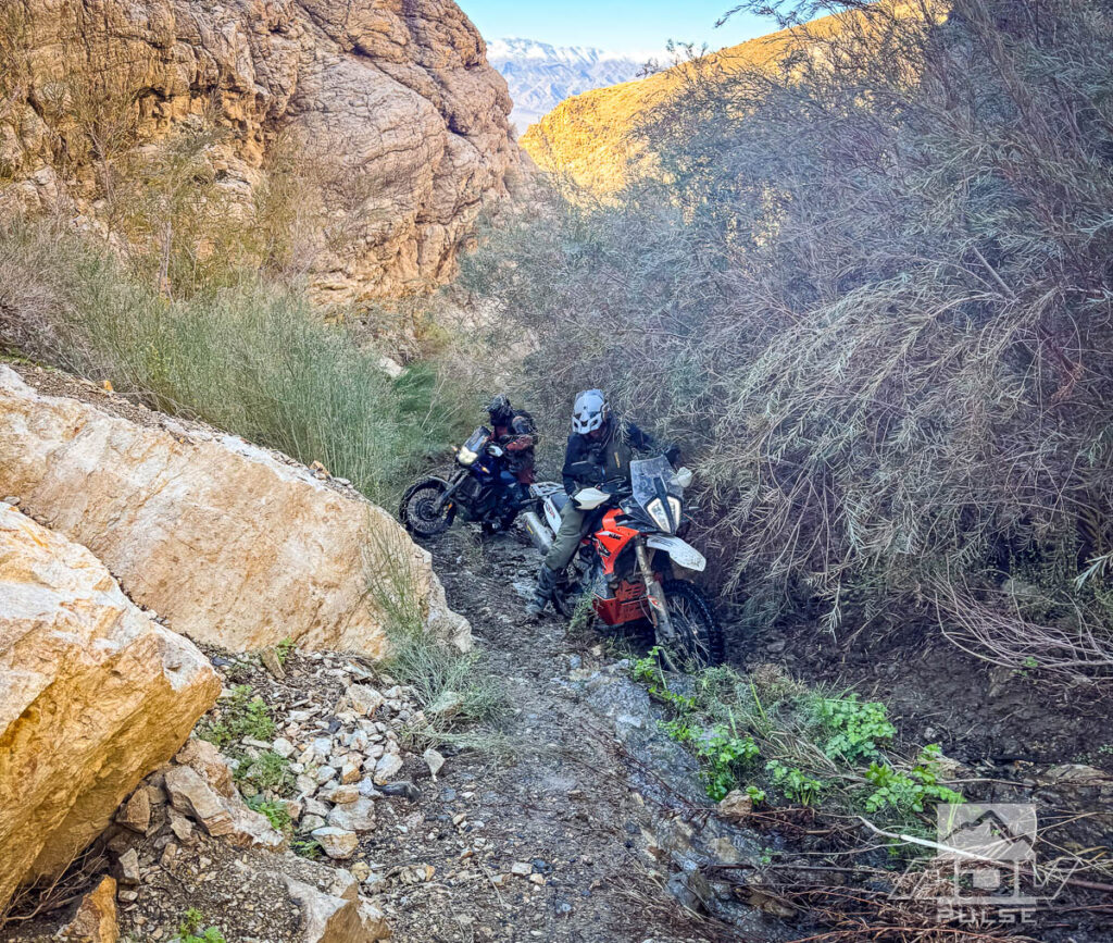
“Ballarart Loop” (a.k.a Pleasant Canyon Loop) is a known thing. After navigating the mess of the valley floor we decided to aim for this loop, but missed the mark, and that is one of the things which saved us from disaster. Originally intending to climb the loop in a counter-clockwise fashion, a somewhat vague entrance encouraged us to opt for the more established trailhead near the town of Ballarat.
Confidently charging up what we thought was the correct route, there were clues that this might not be the way most people climb this mountain. First, there were no tracks. Second, most of the trail involved ducking tree branches. Third, it was a single track. And fourth, it was in a creek.
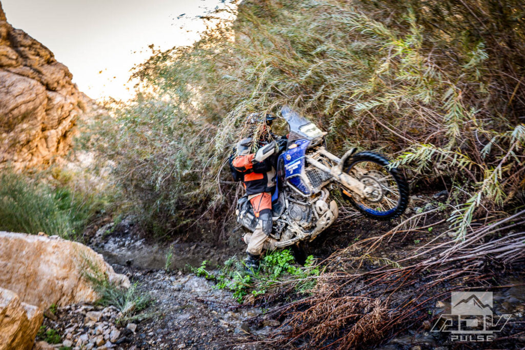
Climbing a steep, flowing creek means keeping your momentum up whenever you can find traction in the loose rocks and mud. Keeping up momentum is made more difficult by tree branches trying to rip you off your bike. These types of conditions always make it that much more amazing when in the middle of the challenge, you come across the rusted remains of a large truck. From Car Wreck MTB trail in suburban Orange County, to this remote offshoot of Panamint Valley’s Ballarat Loop, depositing vehicles in impossible places seems a uniquely American sport from the early days of western expansion.
Ballarat Loop climbs to over 7,000 feet. Even without that information, simply looking at the white caps of the mountains from the valley floor we knew we would encounter snow at some point. As we neared the top of the mountain, my TKC80-shod 690 was sliding sideways along the frozen trail more often than it was going in a straight line. While mild temperatures and sunny skies encouraged pushing forward, deepening snow and knowing the most technical sections of road were still ahead encouraged us to backtrack while we still could.
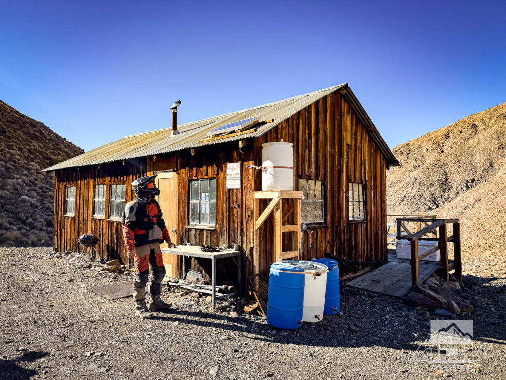

We soon learned this was the correct decision. Arriving back at Rita’s cabin, we encountered another group of motorcyclists checking out the structure, and learned two things. First, they had tried to take an alternate route over the peak, and the snow proved impassible. Second, had we by some miracle made it over the peak, we would have had to do it all over again in reverse, as the back half of the Ballarat Loop had been completely washed away by the storm. It was good information. Had we managed to find the originally intended entrance to run the loop counter-clockwise, we would not have gone very far before the trail ended.
The level of snowfall here was underscored by a SXS driver who stopped to chat with us on his way up the hill. Minutes after our conversation, this same driver returned with a report. He had managed to climb just a bit further than our tracks, but even with large snow tires and four wheel drive, apparently ended up sliding sideways just as much as we had been, and was forced to turn back before reaching the summit.

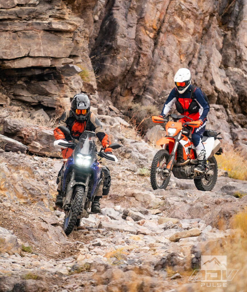
Descending back through the snow, we again reached dry and rocky trail. This section of trail became much more fun than earlier in the day, when Ely graciously offered me the chance to try his KTM 890 Adventure R Rally Edition. While I do like the current version of the 690 Enduro R, comparing the 690 to the 890 Rally, especially in the fast and rocky conditions of the Ballarat Loop, is almost unfair. Nothing seems to deflect the 890’s race-spec WP Pro suspension. It seemed I had ridden up a rocky and windy trail on the 690 and descended a smooth and relatively straight one on the 890.
Just prior to where the main trail reveals massive, dramatic views of Ballarat and the Panamint Valley below, we caught up with a few of the motorcyclists we had met at Rita’s Cabin. A couple of them were paused at the upper exit of the same river/trail we had climbed earlier in the day. Moments later, two more riders emerged from the exit. Looks of disbelief followed our mentioning we had ridden that trail ‘up’ from its base at Ballarat. The two scouts we saw emerge had ridden down a short distance from the top for a quick reconnoiter, and determined that trail was far too technical to ride, even going down.
We had come to Death Valley to ride some of the toughest trails this landscape has to offer. At the conclusion of our trip, the question posed by the mystery desert sage at that first fuel stop in Mojave, and my response, both still echoed in mind. Weather like this can quickly transform an inhospitable desert into an even more foreboding environment. If you’re looking to up the game on an already challenging ride, adding some mud, snow, ice, creeks, and rockfalls could be just the thing. Although, you might just have to wait another 100 years for the next record-breaking weather event to give it a go.
Maps and GPS Tracks
Want to do this ride? A large interactive map and downloadable GPX Tracks are available free.* Note: Zip downloads don’t work with the Facebook app. Download using a regular browser such as Chrome, Safari etc.
* Terms of Use: Should you decide to explore a route that is published on ADV Pulse, you assume the risk of any resulting injury, loss or damage suffered as a result. The route descriptions, maps and GPS tracks provided are simply a planning resource to be used as a point of inspiration in conjunction with your own due diligence. It is your responsibility to evaluate the route accuracy as well as the current condition of trails and roads, your vehicle readiness, personal fitness and local weather when independently determining whether to use or adapt any of the information provided here.
Photos by Ely Woody, Rob Dabney and Mike Massucco
Author: Jon Beck
Jon Beck is fulfilling a dream of never figuring out what to be when he grows up. Racing mountain bikes, competitive surfing, and touring as a musician are somehow part of what led Jon to travel through over 40 countries so far as an adventure motorcycle photographer, journalist, and guide. From precision riding for cameras in Hollywood, to refilling a fountain pen for travel stories, Jon brings a rare blend of experience to the table. While he seems happiest when lost in a desert someplace, deadlines are met most of the time.Related Stories
Related Stories
 ADV Destinations: Geologists Cabin At Striped Butte In Death Valley Tucked deep in the southern reaches of Death Valley National Park, Striped Butte...
 10 Majestic, Iconic & Odd Spots to Explore on a Death Valley Ride Death Valley, California can be one of the most uninhabitable places on earth...
 Finding Hidden Trails and Deep History Riding Death Valley Mile 65.45 of a roll chart dating back to 1984 reads “Lift bike...
Popular Stories
Meet The Phantom 450: A Race-Tested Himalayan Build You Can Buy
The Himalayan Phantom proved its off‑road mettle ...
Toby Price DQ'd From San Felipe 250 For Sabotaging Race Course
Shocking news for one of the most beloved Dakar R...
Yamaha’s Flagship Tenere 700 “World Raid” Is Coming To The US
Tenere fans rejoice! Yamaha is finally bringing...
British Couple Riding Through Iran Receives Harsh Prison Sentence
When Craig and Lindsay Foreman set off from Londo...
Notify me of new posts via email
Great ride and a great read. My first ADV ride was in a hot September 2024, through Eureka and Saline Valley on a 2005 KTM 950 Adventure. It was 177 miles between fuel stops from Big Pine to Lone Pine. I left Big Pine with 6 gallons of fuel and 3 liters of water, and rolled into Lone Pine on fumes and completely out of water. A failed fuel pump in Jackass Canyon added to the adventure, and the first step-up in Dedekera Canyon put me flat on my back with the bike on top of me.